Friday, May 31, 2013

Western Swing 2013 - 9 - Douglas to Cody, WY

Today was another one of those windy days. The difference was that there was some respite from the wind for about 45 minutes. When fighting the wind with a steering wheel, 45 minutes is welcome relief.

This morning we got started about an hour earlier than normal. That means we were on the road by 9 AM. Since our dogs are still on Eastern time getting them to wait until 5:30 Mountain time to wake up is a feat. They stomachs are stuck on Eastern time and they’re used to eating their first meal of the day at 6:30 AM when at home. Martha has managed to get them to hold off nearly two hours.

The wind had died down by the time we were ready for bed from the night before. However, through the night it picked up and started rocking the motorhome on the particularly strong gusts. But, since the problem awning was tied in place we had no problems.

After leaving the Douglas KOA, we saw a sign that said Douglas was hometown to the Wyoming State Fair and the Jackalope. After doing a bit of research, Byron came up with a photo.


The fictitious and fabulous Jackalope.

Leaving Douglas, WY, our route took us through Casper, WY on Interstate 25. We stopped for fuel at the Flying J. Before getting out Byron commented that we had consumed more fuel than the previous drive of nearly the same distance. After he got through pumping he entered the information into his database. The result was that our mileage was cut to 5.81 mpg. Our cumulative average had been 10.35 until the last two days. As you can see, the headwind has taken a toll on the mileage.

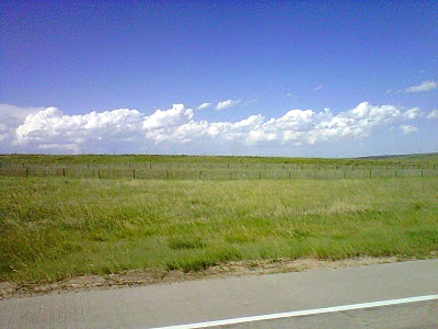
From Casper we headed toward a town called Shoshoni on US 20. In the middle of the small town the road takes a 90-degree turn to the right to head north through the Wind River Reservation. We saw that we’d pass on the east side of the Boysen Reservoir and Boysen State Park, which is a large, man-made lake between Shoshoni and Thermopolis.

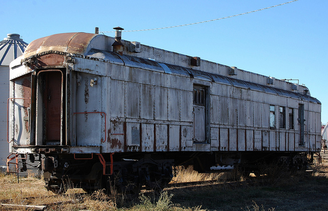
On one overview of the large lake we could see a train on the tracks about two miles away from us. It looked like a model train from our vantage point. We could also see ahead that there were some rocky cliffs. Little did we know that after passing the dam we’d head downward through a narrow canyon. The Big Horn River flows through the canyon. On the western side of the river the railroad hugs the rock cliffs. On the east side the three lane road winds it way downward. At one point we drove through three tunnels one after another.


Tunnels in the canyon walls of Wind River Canyon

After the tunnels came three detours were road construction was going on. However, this didn't detract from the amazing beauty of the place in addition to the man-made creation of rail and road bed so people, like us, could travel through such an interesting place.

Immediately after leaving the canyon with it’s gray-colored walls, the rock ledges on the hills before us were a bright red-orange. The rock changed colors again as we came through Thermopolis, WY. Thermopolis is home to the world’s largest hot springs. The hot springs, like those in Yellowstone, have multicolored rock all around. The difference here is the fact that the pools of the springs is very large. They even have a suspension bridge built over one of the pools for pedestrian traffic.

Pools of the mineral hot springs in Themopolis.

Rainbow-colored terraces of the pools with suspension bridge.

In preparing for the trip, we had no idea we’d see the things we had just passed by. As a former friend of Byron’s used to say: “No amount of planning can make up for dumb luck.” That seems to be what we experienced.

But wait, we’re not there yet. We’re just a little over half way to Cody.

After coming into the town of Greybull we turned westward for the final leg to Cody. As it turned out, this 40-mile trek turned out to be quite interesting as well. First, we drove past the airport where the Museum of Aviation and Aerial Firefighting exists. Parked near the road is Fairchild Flying Boxcar with Canadian markings. Also on static display are nearly two dozen other aircraft including a Boeing Stratoliner and a Beech Super 18 which was used by the smoke jumpers.

Fairchild Flying Boxcar


Boeing Stratoliner (the military called it Stratotanker)

Beech Super 18

For an airplane buff, Byron thought this was an interesting find. What is even more interesting is that the town has a population of less than 2,000. Towns of this size don’t have such amenities in Kentucky.

Just before getting to Greybull and not long after leaving is where the wind seemed rather calm.

As we traveled on westward from Greybull it became obvious we were in the higher arid lands of Wyoming. The ground was much more rocky and sandy, sage brush grew all around and larger rock cliffs lined some of the way. It was also after leaving Greybull that we saw several antelope grazing along with cattle in the fields. By this point in the trip we had also crossed the original Oregon Trail in three places. It is also amazing how irrigation is dealt with in this area. Some fields are suitable for irrigating by running a large pipe around the perimeter. When necessary, water is emitted from the pipe to flow into the field. Since the field is at a slight angle and the rows plowed correctly, the water flows rather evenly over the field. Getting the water to the various distribution points is equally interesting. A system of manmade channels (aqueducts) have been constructed that meander through the area going from a high point of water impoundment. Just like gentle railroad grade, the water flows gently to the lowest point. The system calls for a cooperative effort among the farmer of the Conservation District to take only the water they need and pass the rest on to the downstream neighbors. What is common in this area is rare east of the Mississippi.

The large, rocky cliffs of the Absaroka mountains east of Cody, WY

As we came closer to Cody the snow-capped mountains of the chain in which the Grand Tetons exist could be easily seen in the distance. The views, though changing with each 100 miles of travel, remind us of the Woody Guthrie song: “This land is your land, this land is my land…”

After arriving at the Absaroka Bay RV Park, we went to dinner at Buffalo Bill’s Irma Hotel. We means the two of us and five other officers and spouses of the Diesel RV Club; the reason we are in Cody this time. Before closing this post, it wouldn't be complete without a picture of the most photographed site in Cody, the cherrywood bar and old cash register of the Irma Bar and Grill. By the way, the Irma Hotel is know as “the first hotel in the Rockies”.

Cherrywood bar and old cash register.

Thus far we’ve traveled just about 2,000 miles. It has been enjoyable and amazing. The only thing better than sharing it via the blog would be to have you all ride along with us in person. The one bad thing is that it requires a lot of sitting but it is worth it when we come upon some beautiful and/or interesting sites. We’re seeing things that can’t be seen from the air or from the side of a railroad car on a passenger train. We’re seeing things out the panoramic view of the front window of our Airstream Land Yacht XC.

This land is your land…

Western Swing 2013 - 8 - Denver to Douglas, WY


This could be getting monotonous; the high winds, that is. Is it always this windy just before June?

It is now Thursday and time to leave the Strasburg KOA for yet another KOA to the northwest. Our next layover is in Douglas, WY. It’s another 270 mile drive or about 5.5 hours of driving time in addition to rest and fuel stops.

Once we pulled onto I-70 at Strasburg we could clearly see the "purple mountain majesties" rising above the plains. Looking slightly toward the south we could clearly see Pike’s Peak. What a beautiful sight in the clear, blue morning sky! Though Byron had flown to Denver in 2010 (and driven back to Louisville), he had never seen it from the surface. And, since Martha had never been in Colorado before, this was a totally new experience for her. We both had always heard how driving toward the Rockies was exhilerating as you see the mountains rise above the horizon but we had never experienced it. This is another one of those events that has to be seen to be properly experienced. And, to top it all off, we were not seeing aspen trees.

Martha was pleasantly surprised at what we experienced driving across I-70 an on to I-25. She had always imagined that Denver, since it’s the “mile high” city would be on the side of a mountains instead of on the flat plain at the edge of the mountains. The whole Denver area is actually a collection of smaller towns and cities that butt up to one another. While the roads may have been a bit rough, it seems that they do know how to build attractive overpasses, especially stretching northward up I-25.


The deep blue band of color on the horizon is the Rocky Mountains
coming into view just west of Strasburg, Colorado


The area north of Denver is in a growth mode. From Denver to Cheyenne, Wyoming it seems that every other mile is ranch land and the other mile is filled with new houses and businesses. As to the businesses, every franchise name available can be seen somewhere along the way from a new Cabella’s to a new Walmart with a parking lot actually striped for overnight truckers and RVs. As far as Byron is concerned that Walmart should be called The Walmart Resort instead of Camp Walmart, as most RVers are prone to do. (If you don't understand the statement, ask someone that owns a motorhome).

Leaving Denver the road gradually rises to gently rolling hills and valley to an elevation of nearly 6,000 feet at Cheyenne. More pine trees were becoming more obvious on the hillsides. 

Cheyenne is the northern terminus of the extensive and fast-growing Front Range Urban Corridor. The Rockies begin to reduce in nearness to the interstate just after passing Fort Collins.

However, several miles before reaching Fort Collins we pulled into a parking area so Byron could climb onto the roof and, once again, secure the awning over the slide out. This time he pointed the motorhome into the wind. He had seen an advisory on an overhead sign stating that wind gusts could reach 55 mph and that vehicles with light trailers were advised to refrain from traveling. This time, he used some cord and also reinforced the anti-billow stop on the awning’s roller. We’re glad he did. From Fort Collins on to Douglas, WY the wind was strong from the northwest. We later found that the wind advisory for southeast Wyoming was in effect from 9 AM this morning to 10 PM tomorrow evening (Friday).

After crossing over into Wyoming and going past Cheyenne, the road continues on with a continuing rise and drop in elevation. More cattle could be seen on the large ranches and cottonwood trees were becoming prevalent. They were holding up against the wind rather successfully while we were being blown about by the gusts. We also happened upon what, to us, is an unusual sight. On either side of the road riders on horseback were herding cattle. That’s something we definitely didn’t plan to see but interesting that we did.

There was one place where we were protected from the wind. It was near Chugwater where rugged rock outcrops are clearly visible on the otherwise treeless and lonely plains of Wyoming. Sculpted by years of wind and weather, the rock formations provide an interesting contrast to the prairie scenery. The rock formations also offer a diversity of habitats, which provide homes for a variety of wildlife, including some animals not normally found on the prairie. For instance, there are rabbits, deer mice, bats, snakes, skinks, weasels, and bobcats as well as hawks and owls. Of course, we saw none but did read about them on the sign at the rest stop.

Historical marker at the Chugwater Rest Stop

In the shadows of the outcrops several people have built dwellings along the western side of the road. The outcrops, with steep cliffs of a few hundred feet, provide protection from the westerly winds.

Rock outcroppings along I-25 in southeast Wyoming. The outcroppings
are on both sides of the road with the highway being built
in what is called a basin. This is about 40 before crossing
the North Platte River.

By 4 PM Mountain Daylight Time we arrived at Douglas, WY, named for the senator of the Lincoln and Douglas debates. Douglas is a town of about 6,000 and is lower in elevation by about 1,000 feet from where we had been traveling. The drop in elevation is accomplished over a span of 15 miles or so. We coasted most of the way and felt like we were saving on fuel after loosing mileage on the climb over the 6,000-foot mark.

The KOA is quite interesting. It is one of the few open all year. There are several trailers parked here permanently serving hunters during some of the winter months. The KOA caters to horsemen, too, as there are several rings around the perimeter. In fact, when Byron was checking us in, a gentleman with a truck and horse trailer was also checking in for the evening. He had three horses with him and, yes, there was a fee for each horse to stay the night.

Tomorrow we head on to Cody, our destination in this third of the trip.

By the way, we failed to mention the temperature was 62 when we arrived. When we left Louisville the temps were around 70. In Oklahoma City it was close to 80. Will someone quit messing with the thermostat?


Wednesday, May 29, 2013

Western Swing 2013 - 7 - Across Kansas to Suburban Denver

We’re now at the KOA in Strasburg, Colorado — east of the Denver area by about 20 miles. We’re also happy we only had 270 miles to travel today because it has been a difficult day for traveling.

Typically, we don’t get in a big rush. Doing more than 320 miles in one day is a big day for us. One reason, as stated earlier, is that it begins to wear on Byron. Sitting in the driver seat is only fun for so long. After five hours the legs and knees start wanting room to stretch. Of course, he stops every two hours or so but, still, a five minute walk doesn't do wonders like being able to move about more freely. For Martha, the constant movement while trying to type, focus on the laptop screen, and listen to a doctor dictating notes makes for a challenge after a while. She’s a trooper and only complains when Byron runs across the rub strips. Besides, while traveling around 60 mph time and distance don’t equate to that which can be covered by car. That’s the typical day.

Today was atypical. When watching the morning news on TV we learned that a wind advisory was in effect for a good bit of Kansas and that the day could offer more severe weather than Tuesday. However, weather toward Colorado was more stable with less chances of rain. The issue turned out to be getting into Colorado.

Since we didn’t think we had to be in a hurry to get on the road, we lingered a bit doing some paperwork. We left the campground around 10:30. Thirty minutes after leaving the we heard a noise. A few minutes later we realized the awning on the driver side was starting to billow from the extremely strong crosswind. It had done this before when crossing South Dakota last year. Byron pulled off at the nearest exit. Now, keep in mind the exit goes up in elevation to meet the overpass. That put the coach at the peak of a hill before we could stop and secure the awning. On the peak, of course, the wind is certainly obvious since there’s nothing near to break it’s force. As Byron reports, it created quite a challenge.

He was prepared for a problem, however, since buying some duct tape in Little Rock. At first he attempted to tape the awning to the side from the two-step ladder we carry in the coach. That was too much of a stretch. So, up on the roof he went. Martha told him to be careful. He said he’d crawl so he wouldn’t be caught by the wind. (While crawling, he had visions of being a caped crusader drifting through the air but without the benefit of cape.) Byron was sure the wind had gotten worse, or so it seemed. At any rate, he was able to put enough tape on the top of the awning and the side of the coach to get us to a rest stop. At that point, the wind was coming straight out of the south. It had been coming from the southeast.

At the rest stop we pulled parallel to a tree. It did help break the very brisk wind somewhat so Byron could do a better job of securing the awning from the roof. When he got back in the coach he just sat still for a few minutes before moving on. He said he was shaking inside a bit and wanted to settle down. He definitely isn’t used to doing work in 40 or 45 mph gusts nor does he want to be.

When in Oklahoma City we were at an elevation of 1,200 feet. Wichita is at 1,300 and Salina is in between when it comes to elevation. WaKeeney, where we spent the night, is at 2,450. Strasburg is at nearly 5,400 feet which is nearly the same as the average elevation of the Denver area.

After stopping for fuel near the border with Colorado in Colby, Kansas, we continued on. There is a gradual but definite change in the terrain as we climbed upward in elevation. It also means going from the plains of Kansas into the rolling hills that are on the eastern side of the Rocky mountains. However, we still aren't within view of any mountains. That experience won’t come until tomorrow. Once in Colorado the wind was not as strong but still blowing. This time it was from the north. Seeing the tumble weed roll across in front of us was fun.


Fields along the roadside in eastern Colorado.

Since this was Martha’s first time in Colorado, she was surprised at the gently rolling hills with expansive views of the sky. There are more trees in the large fields but they are still removed from the roadway by a few hundred yards. It was also in Colorado that we saw our first windmill farm since the only one we saw yesterday.

I-70 goes parallel to railroad tracks for quite a distance. The rail line is now that of the BNSF, the merger of Burlington Northern and AT&SF. The line is still active hauling coal and grains.

Strasburg, itself, claims to be the location of the “joining of the rails”. The reality is that it is here, in a town formally called Commanche Crossing, that the last link in the coast-to-coast railroad network in the US was completed. That was in 1870, one year after the Golden Spike even in Utah. It was the linking of an extension of the Kansas Pacific with what would become the Burlington Northern.

Even though Promentory, Utah gets the credit for the joining of the railroads, riders on the Union Pacific, if going east, had to disembark to cross the wide Missouri River by boat. It was not until 1873 that a railroad bridge was built.

Remnants of the glory days of railroading exist in this small town of 2,500 people. Near one of the elevators one can find an abandoned engine that was a switch engine for the Pacific Fruit Express. It's an early Alco diesel. To the east at the end of a siding is an old Denver & Rio Grand Western passenger car. It’s of the heavyweight variety; that means it had cement floor in the effort to provide a better ride. Across the tracks on another siding is an older baggage car built around 1920. Further west are a couple more modern rail cars. One is a sleeper coach with a combination of roomettes and berths (those were unusual). Next to it on yet another siding is a dining car. Further west on a siding is a box car of the 1970’s vintage. Sitting next to it is an old cattle car with trucks removed with  boards still in place though greatly weather by the age. Byron had no idea we would be staying so close to a bit of railroad history. He surmises Katharine Lee Bates, the author of “America, a Poem for July 4”, passed through Strasburg on her way to teach one summer at Colorado Springs. After all, this was the only connecting route into Denver before catching a connecting D&RGW train south to The Springs.


Remnants of another era in railroading can be
easily seen along I-70 in Strasburg, Colorado

By the way, the words of the Bates poem were modified when it was aligned with the music of organist Samuel A. Ward and published as “America the Beautiful”.

It’s interesting that Strasburg is still a town. Promentory, where the Golden Spike was driven linking the transcontinental railroad, is now only a Monument operated by the National Park Service. There is no town within miles of what is an important landmark in our country’s history.

Tomorrow we continue on another 270 miles. We drive through Denver where we’ll turn northward and go parallel to the Rocky Mountains as we cross into Wyoming.

Tuesday, May 28, 2013

Western Swing 2013 - 6 - To WaKeeney, KS via Wichita and Salina


Goodbye, Oklahoma. Hello, Kansas.

Where are we in Kansas, you may ask? The answer is easy. Somewhere between here and there at a KOA 200 yards from I-70. The exact location is WaKeeney, a small town. If you count the town’s old sorehead, it would be 1,818 according to the census of 2010. Oddly, there are two motels here in addition to the KOA. If this were Kentucky town of that size the motels would be in the next town.

The KOA, like most campgrounds in Kansas, is on a the flat prairie with very few trees. The few trees that are here are scarcely 30 feet tall. Those are the tall ones. To have taller trees they must be in a cluster of several trees since one helps the other with wind resistance.


Entrance and office at WaKeeney KOA

We took I-35 north from OKC through Wichita, Kansas. The interstate goes about a mile east of the downtown area where the river runs through town. Byron commented that Wichita has to be the grain shipping capital of the midwest. There were dozens of granaries with several dozen of silos. Where he came from, one grain elevator with eight silos was big. Continuing on through Wichita we turned westward on I-70 at Salina to continue our gradual assent toward Colorado. 

Oklahoma has a lot of cattle farmers (out here, they are ranchers). And, there are a lot of casinos. Several working oil wells can also be spotted. Once across the Kansas border corn and wheat fields were seen. Casinos became more rare and pumping wells became more noticeable. Toward the middle of Kansas one sees more wide-open prairie with grass (well, somewhat wide open). Occasionally a few cattle can be seen. As a friend, who is from Nebraska says, Kansas is a long and lonely state. From what I remember, Nebraska can be, too. On average, it appears that there are six or eight cars per mile of roadway. Towns, like in North Texas, are a few miles apart containing one grain elevator, two gas stations, two churches, and a sheriff’s deputy. Walmart stores are in every other town or so. Other than being flatter than Oklahoma, Kansas is also greener. Oklahoma, however, has 500,000 more residents; which accounts for the lonely feeling when on the road.


A large, concrete-walled drainage channel lies between the northbound
and southbound lanes of the interstate highway in Wichita. These are
common in flatter states to accommodate the typical downpour.

We had a strong wind from our backs as long as we were heading north. Fuel consumption actually improved about 1.2 mpg. However, once we got north of Wichita the wind died a great deal. When we turned west at Salina, the trees were barely moving. However, within 90 minutes a tornado had developed that did some minor damage north and west of the town.

Of all the wide-open space and the abundant amount of wind on these plains, we have noticed only one windmill farm. This, compared with the three places between Indianapolis and Chicago, seems odd. I suppose the challenge is getting the electrical energy from where it can be developed to where it can be used.

A windmill farm along I-70 west of Salina, Kansas.

Curves? Yes. Not all the roads in Kansas are straight. Curves are, however, rather rare and generally subtle. One nice thing is the wide, wide right-of-way along the highway. That is something not found east of the Mississippi River. Depending on the state, we’re more accustomed to trees being 30 feet from the road. Later this summer hay will be bailed in the right-of-way.


Looking west on I-70 in the midst of the great plains of Kansas.

Today we traveled approximately 390 miles. We did make one rest stop and one fuel stop. For us, this is enough to put in on one day. When Martha is working Byron does the driving.

Now, about that history lesson regarding Oklahoma that referred to in an earlier post — most residents know the history of the state. Most of us from farther east aren’t aware of why Oklahoma remained a territory while all the neighboring regions had been admitted to statehood. This little piece of information is for those of us from east of the Mississippi.

As you are aware, Oklahoma was one of the last regions on this continent to be admitted into statehood. Over the process of a few decades, Native Americans were driven from their homeland by the federal government who gave them acreage in what was designated as Indian Territory, the eastern half of present day Oklahoma. This was during the period around the time of the Civil War. In fact, there was an attempt to move many freed slaves westward. This is the reason so many tribes established “nations” by which to rule themselves in their new homeland. To this day the nations still maintain some governance of the American Indian population.

In 1889 Congress opened the western half of the state to settlement after having sectioned it off in the typical fashion; 640 acres per section, one section per square mile, and six square miles forming a township. This land was being made available to white (European) settlers who participated in the land rush. (As a side note, the town of Guthrie was literally built in one afternoon as a result of this action). In this land offer, families could get rural land or town land as a homestead. (See the photo at the Land Run Monument in the previous post).

By the turn of the 20th Century there was clamoring for statehood from the residents. The western half (Oklahoma Territory), was made up predominantly of Republicans, the controlling party that had taken the action to open the territory. The Five Civilized Tribes (those that had adopted English as an official language and had ameliorated into the ways of American culture) formed a union and worked to petition Congress for statehood. Those in Indian Territory were looked upon as leaning toward being Democratic party.

Theodore Roosevelt, the Rough Rider himself, stated he was in favor of bringing the territories formally into the United States. He had met with the American Indian delegation while traveling in the Oklahoma and Indian Territories and told them he was supportive of granting statehood. In fact, he promised to sign a bill into law granting the Indian Territory statehood; the state was to be named “Sequoyah”. With that in mind, the tribes held a convention in Eufaula. They later held a constitutional convention in Muscogee in 1905 and elected delegates to the US Congress to petition for statehood. Had this action been successful, Sequoyah would have been the first state to have a Native American majority population.

The Republican-controlled Congress (and President Roosevelt) gave this action a cool reception once things were formalized and presented in Washington. Roosevelt reversed his position. The request for statehood wasn’t accepted.

Returning from being denied, two of the influential leaders of the Five Civilized Tribes met with leaders from Oklahoma Territory and quickly assembled a structure for joining forces to petition Congress. When all was said and done, a large portion of the constitution drawn up for Sequoyah became the basis for the Oklahoma constitution. When the US Congress was approached again, they voted to admit Oklahoma as one state. That was in 1907.

Now, you may ask, why did Roosevelt reverse his position? The answer lies in the fact that he knew that if the Oklahoma was one state there would be less threat of having three Democrat senators to deal with than one Republican and one Democrat. Sequoyah would probably have voted for two Democrats. The prevalent feeling in Oklahoma Territory was somewhat split with there being a leaning toward the Republican Party.

So much for history and politics. It seems that political tricks are as certain as death and taxes.

Tomorrow we head toward Denver. We’ll have 120 fewer miles to travel since we’ll be staying overnight in Strasburg, Colorado.

Monday, May 27, 2013

Western Swing 2013 - 5 - Oklahoma City Area

Monday, Memorial Day

By the time we were up and moving around it was obvious that weekenders were packing up and heading home. By evening less than 20% of the spaces were occupied.

It was also obvious that someone in Texas was bragging extensively already because the wind was strong and high. We are of the mind that “Oklahoma Strong” probably also refers to the wind. After all, it is windier here than in that windy city east of us, Chicago.

After breakfast we took off for a visit at the National Cowboy & Western Heritage Museum and a lunch with Floyd and Joyce Shealy and their daughter, Joselyn, who was visiting from Houston.

Sitting atop Persimmon Hill, the National Cowboy & Western Heritage Museum features an amazing collection of classic and contemporary western art, including works by Frederic Remington and Charles M. Russell, as well as sculptor James Earle Fraser’s magnificent work, “The End of the Trail”. 20 minutes after being in the museum we realized that we didn’t allow enough time. The museum consists of over 220,000 sq. ft. of exhibit space spread across two, opposing wings in addition to a children’s center for hands-on exhibits.


The first thing one notices after entering the building is that famous and often copied sculptured Native American on his horse. Sculpted by American-born artist James Earle Fraser, The End of the Trail has become one of the most recognizable works of sculpture in the United States. The only works more widely known that it would have to be the statuary that is at Washington, DC. Many people are familiar with this representation of an American Indian on horseback, but few actually know the history of the piece. Most of us are probably unfamiliar with it’s background. After a visit to the museum one learns that it was a meaningful reminder of a childhood spent on the American frontier by it’s creator.


End of the Trail by James Earle Fraser, 1915

James Earle Fraser grew up on the plains in Mitchell, South Dakota where he had many personal encounters with pioneers, hunters and fur trappers. He also befriended many of the Plains Natives and frequently heard stories about the “doomed fate” of the Native people. He sympathized with their suffering as westward expansion of the US by Western Europeans threatened to consume the lands on which they farmed and hunted. As a tribute, he sculpted a model that would later become this famous work done in plaster over a wood and chicken wire base. The End of the Trail was completed in 1915 and first displayed at the Panama-Pacific International Exposition in San Francisco. After the Exposition it was moved to a city in California where it was left exposed to the elements and not properly cared for. In 1968 the National Cowboy and Western Heritage Museum acquired the plaster piece, had it cast in bronze, and the had the bronze statue shipped to California and the original restored and put on display under cover in Oklahoma City.

To either side of this imposing statue lie the two wings of the museum. At one end is a plaster statue of Abraham Lincoln and at the other end is a granite carving of an cougar (panther) called “Canyon Princess”.


Two sculptors adorn opposite ends of the building. Canyon Princess, is 
at the end of the hall on the exhibit wing and Fraser’s 
larger-than-life plaster sculpture of Lincoln 
is on the entertainment wing.

The exhibition wing houses a turn-of-the-century town and interactive history galleries that focus on the American cowboy, rodeos, Native American culture, Victorian firearms, frontier military memorabilia, and a large display featuring western performers. Also in this area are rooms filled with fine art and firearms to Native American objects, and historical cowboy gear. The entertainment wing houses a large banquet hall and restaurant.


Emigrants Crossing the Plains by Albert Bierstadt is an oil painting from 1867. It is one of over 2,000 works of art permanently exhibited at the museum.


In our opinion the gift shop is probably the largest of it’s kind. And why not? With such an extensive and broad collection of items, there are a lot of opportunities for commercialization in a tasteful way. One could easily spend 50 minutes just looking around all the merchandise on display. Warning: Be prepared to spend a lot of money for the nice stuff. (Of course, at that price it shouldn’t be called “stuff”).

The museum wasn't at all what we expected. We were glad another motorhome club member recommended we include the museum in our list of things to do on this trip. The museum is as awesome as it is interesting. Two hours doesn't do it justice.

From there we traveled from the northeast side of OKC to the northwest side to visit with  Martha’s uncle and aunt, Floyd and Joyce, and cousin. Jocelyn had been present for the weekend and was going to leave to return to Houston later in the day. We had a great lunch with them. It was going to be a cook-out but the wind was too strong to be outside unless chasing napkins and hamburger buns is your idea of a good time. We not only had sumptuous hamburgers but also some great-tasting beans from a deli and potato salad from Walmart (once again, Walmart comes through). The dessert was some type of bourbon-laced cake. The vanilla ice cream helped smooth out the sweet taste.

After a two-hour time of discussing a wide range of things from the recent tornado to the dominant accent in Oklahoma, we returned to the campground after having our photo taken by Jocelyn’s mother-in-law. We had a good visit and left things in such a way that we firmly believe we’ll be allowed back.

Jocelyn, Joyce, Floyd, Byron, and Martha

After returning to the coach at the KOA so Martha could do some work, we decided to go downtown for another visit to the OKC National Memorial. It was impressive to be there for Memorial Day. The chairs all had flags placed by them and several had remembrances placed on the seats or wreaths attached to the back of the monuments. The chain, that normally separates the visitors from the memorial lawn, was removed to allow visitors to have a closer view.


From there we went to the Land Run Monument which is at the terminus of the canal in Bricktown. Since we saw one of the sculptures being prepared for shipment to OKC while we were in Santa Fe last year, we wanted to see if it had been put in place. Sure enough, we found it.

Tomorrow we’ll be back on the road as we make our way northward to Wichita and then turn westward for Wyoming as we pass through Denver.

Happy Memorial Day, everyone.

Western Swing 2013 - 4 - Little Rock to Oklahoma City


Sunday morning in North Little Rock -- interesting.

After physically being here for a brief period we now understand the difference between Little Rock and North Little Rock. The Arkansas River runs between the two areas. The northern part of Little Rock (that part north of the river) actually includes a cluster of several communities. The Little Rock-North Little Rock-Conway metropolitan area is about half the size of our own area of Metro Louisville-Clarksville-New Albany. By contrast, the area, except for Conway, is all contained in Pulaski County. The Louisville area is made up of Jefferson County, on the Kentucky side of the Ohio, and Clark and Floyd counties, on the Indiana shores.

Walking and biking trails? Yes, they have them here! In fact, there are many miles one can traverse on either side of the Arkansas River. In addition to the Big Dam Bridge there is the CO&G railroad bridge and another bridge further up river dedicated to pedestrian and bike traffic. The paths wind through at least six parks that line both sides of the river. The development of the paths arose simultaneously with the initiative of the mid-1990s in revitalizing the riverbank which comprises the River Market district, the lifeblood of Little Rock's downtown area.

Another thing we had never noticed was how hilly the county actually is. When traveling on from Memphis to Texarkana one may think that it's on a flat plain. I-40 is rather flat between Memphis and Little Rock but it ends in LR. Just west of Little Rock's downtown, large hills on a rock base are soon encountered. The same is true of North Little Rock. The hills on either side of the Ohio in Louisville are not as steep except for The Knobs in Floyd County. The river banks here are steep. Even then, the hills are further removed from the river making the river valley rather wide.

OK -- enough with the lesson on geography.

This is Sunday. In the life of a Christian it means the opportunity to attend worship and/or Bible study with other Christians. We took advantage of that opportunity to engage in a worship experience. There were four churches within one mile of the KOA. We selected The Summit Church because they had a service at 9:00 which would allow us to get out in time for check-out at 11 AM. At 10:20 we left as the service was beginning to come to a close. The sermon was well-delivered and appreciated. It was about the responsibility Christians have in creating peace in our relationships.

As one might expect, this church has only a “contemporary” service (the opposite of a “traditional” service). That said, we weren’t quite prepared for one subtle difference; they refer to the room for corporate worship as “The Theater”. One wonders about the theological implication with regard to that name. Sanctuary still seems appropriate regardless of cultural experience or the rock concert style of musical production.

The KOA in North Little Rock is adequate. One can tell that it is an older campground in the system because of the length of the sites. They’re short by today’s standards. Still, it meets our needs. The sites were made of gravel with at least one mature for each camping space.

We left at nearly noon for the trip to Oklahoma City. The sky was filled with billowy clouds. Martha had never been on this part of I-40 and Byron had only driven from Little Rock to Russellville in 1976, a long time ago. From there through Fort Smith and Oklahoma City was new for us. The highway generally stays within a few miles of the Arkansas River through Arkansas and into eastern Oklahoma. The gently rolling hills of the road are between the Ozark and Ouachita National Forests. Since Martha wasn’t working today, she assisted with some of the driving. During the weekdays, she sits at her computer doing dictation while Byron does the driving.


The course from Little Rock to Oklahoma City is within easy reach of the “Trail of Tears”, the course the Cherokee, Seminole, Choctaw, and other nations took in their forced migration from the lower Appalachians and southeastern part of the USA. At the time, the Anglo-European settlers of our country thought the “civilized” natives would do well on reservations and, since Oklahoma was virgin territory, it would be suitable. After all, those non-white people had no deed for the ground they had lived on and farmed in the southeastern part of the country. More about that later.

One of the nice things about traveling by motorhome is that a good meal is always nearby. We like the meat entrees from Hormel. They always do well in the microwave. After having pork with gravy, rice, and slaw while sitting at a rest stop, we continued on our journey westward into Oklahoma.

As we traveled past Shawnee we started looking for evidence of the tornado that hit there the day before the tornado touched down in Moore. Sure enough, just west of Shawnee and south of I-40 we saw homes demolished and mature trees broken and fallen. The path of the storm was easily identifiable.

We arrived at the KOA before 6 PM after pausing for dinner at a rest stop. Mileage covered was 315. We were in time to watch the community memorial service that was hosted by the state’s governor at the First Baptist Church in Moore and broadcast on all the local stations.

When the tornado was ripping across Moore, Byron noticed that it was starting to lift just before Choctaw where we had a reservation at the Oklahoma City East KOA. He had checked with them before our arrival and found that they only had minor damage caused by the stiff wind and baseball-sized hail. Once parked and setup, we could see no evidence of any of the storm’s destruction from the previous week except on our walk around a hiking trail on the periphery of the campground. We saw some bits of insulation in a couple of places but that was all. We also saw a tremendous amount of poison ivy among the trees but it wasn't blown in from a storm. It was growing there just waiting for us to avoid.


The KOA is very nice. Each space is clearly defined with several live oak trees at each site. Though on the peak of a hill, the sites are flat with terracing between each one where necessary. After the hike, doing a load of laundry, and watching a bit of TV we turned in for the night. Tomorrow we plan to go to the National Cowboy & Western Heritage Museum in the morning then head to the home of Martha’s uncle and aunt for a cookout.

One other thing to notice about traveling west; one sees more trailers and fifth-wheel units than motorhomes. The reason is that a significant part of the population have trucks. Or, as a salesman at an RV dealership put it, “motorhomes are for the city slickers.”

Saturday, May 25, 2013

Western Swing 2013 - 3 - In Little Rock

Today was the Saturday before Memorial Day. Traditionally, Memorial Day is the time to remember those who died in service to the Country. It's also a good time to expand on that theme and pause to remember those who have preceded us in death and to also look at some aspects of our history. It's a good day to be in Little Rock because this is where the Clinton Presidential Library and Museum are located.

Byron’s first visit to a presidential library and museum was the one set aside for Lyndon Johnson, who was president during the time of the Vietnam War. That was also the time Byron was eligible to be drafted and the time of great civil rights activity in the country. Therefore, he didn't have a real “passion” for paying a visit to anything “Johnson”. However, after going through the edifice in Austin, he soon changed his mind because he learned that the museum are really about American history during the time that the particular president was in office. As far as he was concerned, that put things in a different light. In reality, however, Byron was reminded of a lot of history that he had lived through as a high school and college student. He came away with a new-found respect for Johnson as well as an expansion in his understanding of American History from 1963 through 1968. Martha, of course, was much to young to remember much about the Johnson era.

The Clinton Library is an interesting structure; it’s a cantilevered construction of glass and steel. The lobby area and the second and third floors are open to the public. The lines are straight and nothing particularly interesting catches the eye, though there is a “green roof” complete with a lawn and interesting plantings.


The William Jefferson Clinton Presidential Library and Museum

The library and museum is a part of the National Archives and Records Administration system. At present, there are 14 such facilities. The Lincoln Presidential Library and Museum, which we visited last year, is not a part of that system mainly because the NARA was yet to be established (1955).

The permanent exhibits tell a story of the Clinton Presidency. They feature the campaign, inauguration, and special policy sections that highlight the work of the President, including that of the First Lady and Vice President Al Gore. The exhibits are a historical walkway of the Clinton Presidency through photographs, video clips and numerous artifacts.

In the lobby is a simple exhibit regarding the work of the Secret Service. The focal point of the exhibit is the 1994 presidential limousine. Next to that was a room with the jazz photographs, which was interesting in it’s own right.

On the second floor is where visitors view the video overview narrated by Clinton himself. He begins with his great interest in music and his even greater passion for politics. From there it moves through some facts about serving in Arkansas. Neither of us were particularly aware that he had served Arkansas for a total of five terms. Four years separated his first and second terms. That made him the youngest governor and the youngest ex-governor.

After leaving the video we moved into the exhibit area on the second floor. This included a full-size replica of the Cabinet Room where guests are welcome to sit during a brief presentation by a guide. The remaining area was actually a collection of u-shaped alcoves separated by library shelving and archival boxes. Each one, approximately sixteen in all, serve as the focus of attention regarding one aspect of the Clinton presidency. Actually, about half are made up of two alcoves and the others are individual areas since the displays don't demand more space. One of the areas was about technology during the Clinton years (1993-2000). One photo Byron “had to get” was of the two Macintosh computers on display; the “Classic” and the second-generation iMac, which is fondly referred to as “lampshade.”

Macintosh Classic and iMac -- the only two computers displayed
in the technology alcove.

From there we went to the third floor. The central area on that floor is an exact replica of the Oval Office as it was structured during the Clinton years. What we didn't know was that there is a presidential seal on the ceiling. Visitors, however, are only allowed to look into the room through the four doors.


The Clinton version of the Oval Office. Busts of other presidents
are dotted around the room on furniture and shelves.

There were also two, temporary exhibits on view. One was entitled “Jazz: Through the Eyes of Herman Leonard.” It featured over 40 large-scale photographs of famous jazz performers from the 1940s and 1950s as well as a few instruments and other artifacts. The fashion exhibition celebrates the world-renowned work of designer Oscar de la Renta. The exhibit features more than thirty of his creations worn by pacesetters of style, from First Ladies to Hollywood’s brightest stars.

One of our favorite photos was taken in the last year of Clinton's administration. It show him at the Oklahoma City National Memorial, which we visited last year. It still causes a sense of awe and sadness to grip us when we think of that horrible tragedy. Clinton visited on April 19, 2000 to mark the fifth anniversary of the event.


President Clinton visiting the OKC National Memorial on
April 19, 2000.

An interesting aspect of the museum is that it presents the Presidency in a positive manner. As it particularly relates to Clinton, there is little space given to any mention of Monica Lewensky. There really was no need for this because the library and museum are more about the history of our country during that era rather than about the person, himself. The feature of that alcove is about the impeachment effort which, in spite of the moral issue, was more about Republican/Democrat politics than anything else.

Across the way from the library and museum is a restored railway passenger station that was built to serve the Choctaw, Oklahoma & Gulf railway. It is now home to the Clinton School of Public Service of the University of Arkansas. Immediately north of the station is another pedestrian bridge (we have counted at least three such bridges) that also served the CO&G. The railroad had operations from Memphis to Oklahoma City. In 1904 the line was involved in a hostile takeover by the Rock Island Line.

Before leaving the city area we drove past Central High School, which became a place of focus in the civil rights movement in September 1957. Byron remembers watching “live coverage” on TV as the Arkansas Nation Guard turned away nine students. The building is now a National Historic Site of the National Park Service though it continues to be an operating high school serving more than 2,000 students. To tour the school one needs to make reservations.

Day Three ended with dinner at Cock of the Walk and a visit to a Walmart for a few groceries. Tomorrow we head for Oklahoma City after attending a nearby church for worship.

By the way, if you want to know more about the presidential libraries, check out Presidential Libraries: History Uncovered developed and managed by C-SPAN.

Friday, May 24, 2013

Western Swing 2013 - 2 - Memphis to Little Rock

It's Friday morning and time to head for Little Rock. By the time we had coffee, worked some using our computers, had breakfast, took showers, and then walked around the campground it was nearly 11 AM and time to check out. As you can tell from the photo below, we weren't among the first to leave. When we pulled in last night there were two spaces open on either side of us. Before we went to sleep all the spaces were filled. By 11 AM this morning, however, we were the only ones left among three rows of spaces.


Leaving from the KOA we headed south on I-55 for a few miles and then turned westward to travel on I-40. The section between Memphis and Forrest City is, by far, one of the busier and rougher sections of interstate in the USA. Two construction zones caused us to loose only a little time on our trek of 150 miles for today.

We arrived at the KOA in North Little Rock well ahead of the rest of the crowd. While Martha did some transcription work Byron got us set up, the car disconnected, and a few other small tasks.

Martha selected an interesting place for supper; Whole Hog Café and Catering. She had read reviews on TripAdvisor.com and thought we should check it out. Byron agreed it would be OK in spite of the fact that we were 10 miles closer to Little Rock’s Cock of the Walk. We’ve eaten at the Nashville location near Opry Land and know their hospitality and fish to be excellent.

As soon as we exited the Interstate in downtown Little Rock we were in the midst of a traffic jam. As it turned out, this was the first night of a weekend festival called Riverfest. We were in stop-and-go traffic through nearly a dozen blocks of the downtown area but we did make it to Whole Hog Café before the Friday evening rush. We knew that the place had to have good food because there were police cars in the parking lot. When we got inside two firetrucks pulled up. In addition to us, there were eight policemen and six firemen (dispersed around the room) present for dinner. Oh, we did see three other couples in a place large enough to seat 150. It was also easy to see why the place is an award-winning restaurant for barbecue, they offer seven different sauces. Six sauces are placed on each table with a sign stating that one can ask for the hottest and spiciest variety. The photo (below) doesn't quite tell the whole story but you get the point.


For all intents and purposes, the restaurant is like a fast food place. You place your order, receive a receipt with order number, prepare your own drinks, then get your own food when the appropriate number is called.

Well, the plain truth is this; we prefer Mark's Feed Store in Louisville for barbecue. We had a taste of pulled pork, beef brisket, and pork ribs. The sauces were good but the brisket could have been more tender and the ribs less crisp (overcooked). However, like good members of the Clean Plate Club, we didn't disappoint the help by leaving food on our plates.

Now, what does one do after having a big dinner? You walk it off. One other point of interest Martha found on TripAdvisor.com was Big Dam Bridge. It's located at the Murray Locks and Dam on the Arkansas River on the western edge of Little Rock. To get there we drove along miles of river which included three, distinct parks and a golf course. The pedestrian bridge is high above the locks and dam. The ramp up to crossover reminded Byron of the hike up to Clingmans Dome in Great Smokey Mountains National Park; it's a gradual incline that finally reaches a proper elevation. Once out on the bridge it was obvious to feel the sight we had noticed; 30 mph winds and flag flying straight out.


Big Dam Bridge, a pedestrian bridge, is built over the
Murray Dam and Locks on the Arkansas River.

We went to the half-way point then turned around to go back. It is possible to walk along the southern banks, cross over, and walk along the northern banks on the wide bike/walking path.

The half-way point of the pedestrian bridge. The flags were standing
straight out because of the brisk and steady wind.

Day Two came to a close with us catching up on work and email. Total mileage for today was at 150 highway miles plus a 25 mile loop around Little Rock. Tomorrow we head to the Clinton Presidential Library and Museum.