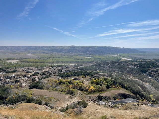
We left our motor home at the campground for the day. Using the car as our mode of transportation, we headed back to Theodore Roosevelt National Park.
TRNP is unusual in that there is not an interior roadway to allow visitors to drive through from one end to another. We decided to head to the North Unit first, about an 90-minute drive from Dickinson. (On the way we observed quite a number of new oil wells actively pumping).
After arriving at the North Unit, we watched the short video about the park before actually heading into the park. The North Unit has a 14-mile road that ends at Oxbow Overlook. We also stopped at River Bend Overlook and took the short walk to the stone shelter built by the Civilian Conservation Corps in the 1930s.
It is here that one should stop to admire the contributions of the Roosevelt presidents, Theodore and Franklin. One initiated the setting aside of land for public use while the other initiated programs that resulted in enhancing the parks for exploration by visitors by building trails and structures. Both were considered progressive for their times though one served as a Republican and the other as a Democrat. And, yes, they were closely related through family ties and states of residence.
After a picnic lunch at Oxbow, we headed back toward the North Unit entrance/exit and stopped for a 1.8 mile hike before exiting the park. At times we were following following a bison who was also making his way through the park. Interestingly, the bison will climb more steeply up some hills than we humans choose to do. We walked through both areas shaded by trees and bushes while other parts of the trail were fully open to the sun.
We arrived at the South Unit in Medora about mid-afternoon and viewed the exhibit in the Visitor Center there. At the back of the building is the Maltese Cross Cabin in which Roosevelt once lived.
The South Unit area of the park is less dramatic as far as the geological makeup is concerned. It does, however, support more wildlife including the prairie dog towns. Though they are difficult to see, the prairie dogs offer some interesting entertainment.
We drove back as fas as the Wind Canyon Trail for a short hike. This canyon is interesting. Most of the other portions of the park have been shaped by water erosion. This canyon has been and is being shaped by the wind.
The Sioux called this area mako shake which means “not good land.” The frontier soldiers that traveled through this area called it “hell with the fire put out.” Roosevelt said it was “land of vast silence – a place of grim beauty.”
As you well know, pictures don’t do justice to the majesty of the land and views to be seen. Though the North Dakota Badlands aren't as colorful as the South Dakota Badlands, they are still fascinating yet more compact. If you travel this way and stop at the Painted Canyon rest area, you'll miss the close-up experience to be had by traveling through both sections of this park.


No comments:
Post a Comment