Thursday, October 26, 2023

Days 48-51 – 10/22 - 10/25 – Interesting Scenery from the Windows

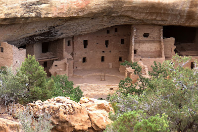
 OK, folks. These are our travel days with no stays for visiting the local areas. Just travel. Sounds boring? Not so. Keep in mind that wherever you go throughout the USA, the landscape (topology) can change drastically and often. Each area has it’s own beauty and reason for being as it is.

Colorado to Texas Map

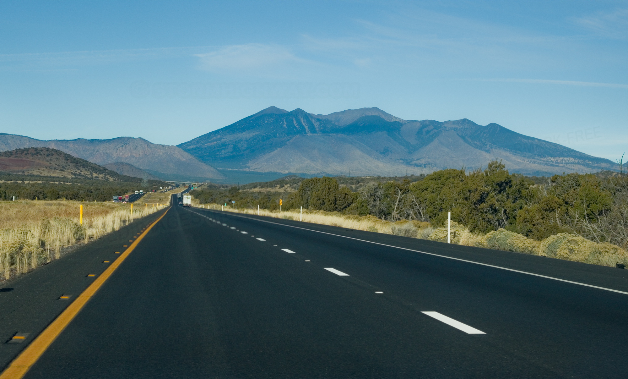
We left Mancos, Colorado on Sunday, October 22, and headed east toward Durango before turning southeast toward Albuquerque, New Mexico. We crossed the southern Continental Divide about 60 miles north of Albuquerque at 7380 feet elevation. When we crossed a northern Continental Divide in Montana we were a little over 6000 feet. Since that crossing north of Albuquerque, we’ve been on a downhill trajectory. Yes, we’re over the hill in more than one way.

River through Durango
As we turned south in Durango, we encountered a scene that
was quite colorful for the region. The cottonwoods, always
found near water, had changed to their golden, fall color.

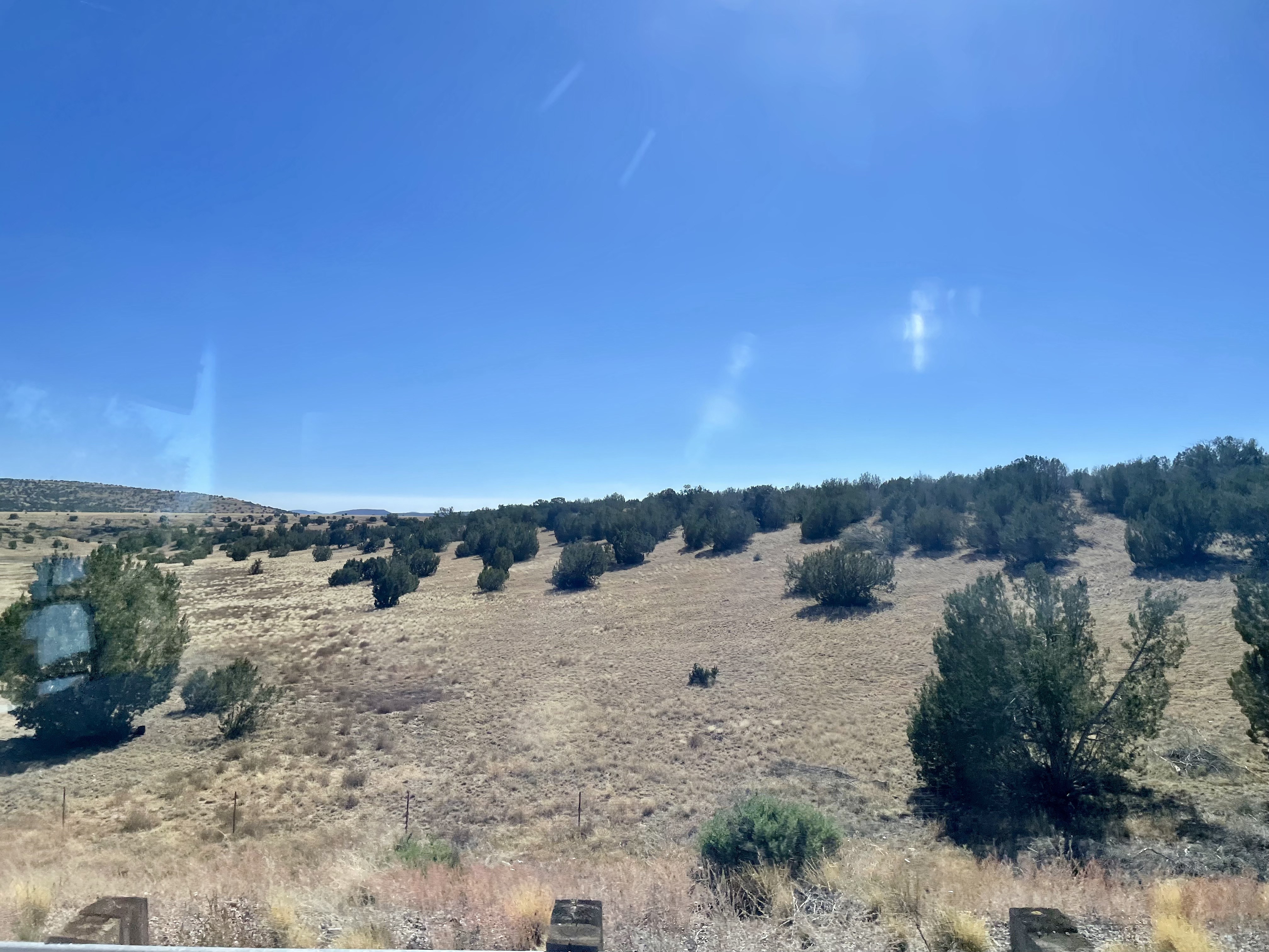
Monday’s travel was between Bernalillo, NM and Clovis, NM (October 23) in more of an easterly direction. We were still in somewhat desert-like territory for a portion of the journey.

near Albuquerque
The formations that “jump up” in the middle of the wide-open
spaces is always amazing.

Tuesday, the 24th, when headed toward Sweetwater, Texas which is west of Abilene. We were on flatter ground that we had been for some time. We had also returned to civilization in terms of distances between towns not being so great and farm or ranch houses also being closer together. Farmland? Yes, that was also experienced. Then, before getting into Sweetwater, we started seeing a great number of windmills (alternative energy production) across much of the landscape. In fact, what we were seeing is called the Sweetwater Wind Farm which boasts 392 turbines manufactured by GE Energy, Siemens, and Mitsubishi. They stretch across 144 square miles of West Texas. When built, Sweetwater was the biggest wind farm in Texas, and in the world, when it was built. Below many of the turbines and blades were oil well pumps, 90% of them standing idle.

Sweetwater Wind Farm
Much of the Sweetwater Wind Farm is in open farm country
though several are in former oil fields.

at Travelers World
Settled in for the evening, we enjoyed being where there was
grass and not just rocks and dust. Click on the photo
to see an enlarged image then look at the price
of gas and diesel fuel — get it while it is “on sale.”

Our last day of travel, Wednesday (10/25), was a little more harrowing than expected. We encountered heavy rain as we left Sweetwater, Texas. We encountered a few accidents upon approaching Abilene that slowed traffic. Then, in bypassing Abilene we had to dodge a wet, wandering dog in the center lane of traffic. Within miles of that scare we had a small sliding experience with a slick road surface caused by the heavy rain. Thankfully, everything was kept under control and we arrived in Leander, Texas with no further incident. In fact, by the time we arrived the dark skies had given way to an overcast condition. We were safe and sound.

Leander KOA Journey
We encountered an internet friend of Byron’s at the
Leander / NW Austin KOA. He was a member of a
Facebook group Byron started for work campers in 2017.

Even though we’ve traveled four to five hours every day, it has been nice to have some down time each afternoon and evening. Tomorrow, we head to College Station, Texas to visit the George H. W. Bush Presidential Library and Museum on the campus of Texas A&M University.

Tuesday, October 24, 2023

Day 47 - 10/21 - Visiting Mesa Verde National Park

This was a great day for a visit to Mesa Verde National Park in southwestern Colorado. Martha was fortunate to secure one ticket for a Ranger-let tour of one of the cliff dwellings. Byron said for her to go on and take advantage of the opportunity since getting a ticket was difficult because it was the last day for the season. So she could make the tour, we got an early.

greetings from mesa verde
One of the fascinating elements first seen when entering
Mesa Verde National Park is this imposing formation
known as Overlook Point. It is the smallest mesa in the park
by length and width on the top.

By the way, a mesa is an isolated, flat-topped elevation bounded from all sides by steep escarpments and stands distinctly above a surrounding plain. Mesas generally consist of sedimentary rocks capped by a more resistant layer of harder rock like shale overlain by sandstone. The flat layer acts as a caprock to form the flat summit of a mesa.

welcome to mesa verde

The tour was of Balcony House and the meeting place was 20 miles into the park. Since the speed limit in national parks is, at most, 35 mph which is why the early start was required. After all, we had to go from the entrance to the mesa (a change in elevation of nearly 1,000 feet) going through many switch-backs at less than 20 mph. According to what she read, the Balcony House Tour is the most strenuous (there are two others). And, as one of the rangers put it, most people make it back.

The ticketed group departed the parking lot and descended 135 stairs to a paved path along the edge of Soda Canyon. That took them to the first ladder and a climb of 32 feet upward. At the base of the ladder, was a “seep spring.” Seep springs are sources of water created by water draining through the sandstone. The water runs along ledges and pools in shallow places.

first ladder
After climbing down to an access level, the tour continues by
climbing up the 32-foot ladder to the alcove level of the dwelling.

the seep stream
The seep stream supplies “running” water to the inhabitants
of the dwelling. That the stone of the mesa collects and holds
water is an amazing thing because drilling a well would be impossible

After climbing the ladder, the group walked through a narrow passageway to enter the alcove of the Balcony House. Most of the cliff dwellings were built closer to the base of the canyons but Balcony House was built 600 feet above the Soda Canyon floor. The alcove was 39 feet deep and 20 feet high. The complex is about 264 feet long and is believed to have had 38 rooms and 2 kivas. It is believed the Balcony House may have been used for educational purposes as well as cultural and ritual ceremonies. The rectangles in the walls are not windows but, in reality, are the actual doors the people entered through.

narrow passage way
Access to the alcove and the rest of Balcony House
is through this narrow opening.

entering the alcove
After going through the narrow passage, one enters the alcove.
This is the first view of what remains of the dwelling. Walls were
built from bricks fashioned with a mixture of sandstone and water.

wall reaching to ceiling
The areas where the dwellings were built had been carved by the
wind and water under the capstone of the mesa. This photo
shows how the main walls were built to connect to
the naturally-formed ceiling.

Leaving the alcove, the group climbed a short ladder and used steps chiseled in the rock to move to the area with the kivas, the courtyard. Kiva roofs were constructed of logs and adobe. They were level with the surrounding surface. The 3' x 3' hatchway in the center served as entrance and smokehole. A vent tunnel was also dug to the surface so a draft existed when a fire was burning.

kiva in the courtyard
In this photo, one can see the rooms and walls of the remains.
In the center of the photo is a ladder extending from a kiva.
Note that there is a vent on the wall that serves a basic function.
The cliff dwellings used the highest form of construction
developed to that point in time (1000 CE).

a kiva at mesa verde
A kiva was a space used for rites and meetings. Among the
modern Pueblo peoples, “kiva” means a large room that is
circular and underground, and used for spiritual ceremonies.

she was there
Here is proof that Martha was there. As mentioned earlier,
what looks like a window was actually the doorway.
Inhabitants accessed a door by way of a ladder.

At the end of the tour, the group exited through a 12' long tunnel that was about 18" wide. At the end of the tunnel was a 17' ladder that led to a shelf. Once at that level, the group ascended stone steps and climbed another 17' ladder to the parking area.

exiting Balcony House
Exiting Balcony House meant crawling through
this tunnel to get to another shelf or alcove of the cliff.

ascending the ladder
Byron took this photo of Martha at the top of the final ladder.
She made it! She was bit winded but glad to have made the tour.

Balcony House NPS
This is an official NPS photo of Balcony House as viewed
from across Soda Canyon.

a different cliff dwelling
Evidence of the approach of Fall can be seen in this photo taken from across
the canyon. The Mesa Top Loop provides excellent viewing points
of several of the cliff dwellings.

After Martha met Byron back at the top (Balcony Parking Lot), we headed to the museum to watch a short film about the Ancestral Pueblo people who lived in this area for 850 to 1000 years. Before arriving in the area, the people had been hunter/gatherers. However, when they came to the mesas, they took up farming. By becoming farmers, they had to build dwellings so they could live in the location throughout the year. At first, they built pit houses on the cap of the mesa. It was later than they found safety in building their dwellings on the sides of the cliffs under standstone alcoves (shelves) that stuck out from the capstone. They raised corn and squash as well as turkeys. In addition, they still hunted for animals and gathered berries, etc.

After seeing the video, we had lunch at the parks grill. Byron had a grilled chicken sandwich that he said tasted better than any he’d had at Chick-fil-A.

Following lunch, we took the 6-mile drive around the top of the mesa. The 6-mile Mesa Top Loop takes visitors through 700 years of Ancestral Pueblo history. From remains of early pithouses and masonry villages to multi-storied cliff dwellings, archeological sites along this loop show how early Pueblo architecture evolved. Archeology and Pueblo oral histories shed light on what life may have been like for people who lived, worked, and raised families here for generations. There are 11 stops along the route. For us, it was hard to imagine that had all been done seven centuries ago and then abandoned by the ancestral people when they moved farther south.

We ended the drive around the loop at a viewing point for Cliff Palace, North America’s largest cliff dwelling with 150 rooms and 21 kivas. Cliff Palace stands as a grand testament to the engineering, architectural, and design achievements of these ancient Pueblo people.

changes over time at mesa verde
A composite of pictorial information about the changes at Mesa Verde before
the inhabitants migrated south around 1300 CE.

yes, he was here
Here is proof that Byron was here, too.

On our way out of the park, we stopped at Park Point which is as an elevation of 8,572 feet…highest point in the park. Before leaving, we went to the Visitor’s Center at the park entrance. Why? It was closed when we entered the park early in the morning.

at Park Point
Oddly, the fire tower is only operated during the summer months
which is the rainy season. The reason? To watch for lightning strikes.

view northward
We thought we could see Rock City from the northern view
of Park Point. For sure, we could see into other states.

pottery display
This is a display of pottery and jewelry found on the mesas.
At the Visitor Center, we learned that the people had been using
tightly woven baskets before developing the ability to create pottery.

This was a wonderful park about people and their survival.

Our visit to Mesa Verde was the last on our list of national parks on this trip. Mesa Verde was wonderful and informative since it conserves the natural beauty of the region in addition to preserving some of the history of America’s indigenous people; people to whom we owe great respect.

We still have both Bush presidential libraries as well as the Johnson library and museum to visit before we return home. Stay tuned.

FYI, here’s the video shown at the museum.

Monday, October 23, 2023

Day 46 - 10/20 - Flagstaff to Mancos near Cortez

It was another one of those travel days. Our journey took us eastward on I-40 to Gallup, New Mexico where we turned northward to head to Cortez, Colorado. At Cortez we turned east and drove a few more miles to Mancos, which is at the entrance of Mesa Verde National Park.

The scenery changed many times along the 325 mile route. Around Flagstaff there are still a variety of pine, spruce, and juniper trees on the sides of the mountains. Though we drove by Winslow, we didn’t stop for a photo at a famous corner. Then, in less than 15 minutes of travel the landscape changed back to high dessert with yucca plants, sagebrush, and stubby trees and shrubs. Of course, we encountered some old roadbed of US 66. In another few minutes we were driving through Petrified Forest National Park while being parallel to the BNSF tracks. We commented to each other as to the number of trains we saw along a 30-mile stretch. Around Petrified Forest we could see the multi-colored formations shaped like teepees.

Then, at Gallup we turned north on US 491 and drove through Navajo lands before reaching the Ute Reservation south of Cortez. The landscape was high desert with mountainous areas and wildly varied rock formations shaped by exposure to wind. Though the roadway was in good shape, there were places where ground heave took advantage of the situation and presented several spots where dips in the pavement made it seem like we were encountering stiff waves.

Yes, we could have gone through the four-corners area. We elected not to because of the elevation difference. Though we’ve done so on this trip in other places, the roads and grades over the passes through that area are a bit hostile. That is why we drove to Gallup before going northward.

rock formation north of gallup
This formation on US 461 between Gallup and Shiprock
is the most photographed formation on that stretch of road.

Chuska Mountains
While traveling through Navaho, the Chuska Mountains with
their volcanic rock and pine tree can be seen briefly.
Geologically, they are on the southeastern edge 
of the Colorado Plateau.

Mesa Verde RV - 1
Our site at Mesa Verde RV Campground in Mantos, Colorado.
It was the widest and longest sites we’ve had on this trip.
The all-rock surface is from the region.

out the windshield
This was our view looking northward from our RV site.


Sunday, October 22, 2023

Day 45 - 10/19 - Day Trip to Sedona

Though we are spending two nights in Flagstaff diidn't mean we had to stay. After all, we had visited Grand Canyon NP in 2013. So, we headed south about 32 miles to Sedona, an area where we have never been but wanted to see we heard it was a beautiful place. Sedona didn’t disappoint even though the town, itself, is the touristy Gatlinburg of the west. If you like crowds, slow traffic, and shops galore, go to Sedona or Gatlinburg. But, if you want to see the other aspects of the locations you have to get away from the retail environment. Of course, what is seen around Sedona is vastly different from what can be witnessed around Gatlinburg and the Great Smoky Mountains.

approaching Sedona
As we exited our twisting ride through Oak Creek Canyon,
we were presented with a clear view of Cathedral Rock,
a formation of rocks that prominently overlook Sedona.
It is a natural sandstone butte and one of the
most-photographed sights in Arizona.

Our route took us down in elevation through the Oak Creek Canyon. As one would imagine, Oak Creek goes from the upper elevation of Northern Arizona toward the Verde Valley. The canyon walls are always not far from the creek and roadway on either side. Of course, the many curves along the path made for an interesting drive in addition to the changes in the types of trees in transitioning from altitude to another.

oak creek canyon - wikipedia
This photo, from Wikipedia, show how deep Oak Creek Canyon is.
It was formed along a fault many, many years ago. The canyon is often
described as being a cousin of Grand Canyon because of its scenic beauty.
The hairpin turns of State Route 89A run for about 13 miles from
south of Flagstaff to just north of Sedona.

Our first stop was the Sedona Visitor Center where we talked with a delightful lady from Cincinnati, Ohio. She gave us maps and good information. Then, we set off for a brief visit around Sedona.

We had planned to hike to the base of Chimney Rock. Where the trail was to begin we came upon the Amitabha Stupa, a Buddhist location. Stupas are the oldest form of sacred architecture on the planet. While we don’t embrace the Buddhist beliefs, it is interesting to visit these outdoor centers created for meditative experiences. It was very characteristic of the Buddhist Garden we encountered in Montana. It though similar, was on a grander scale. The Amitabha Stupa is very simple in comparison. Even though these structures are outdoors, there is a sense of reverence as you approach the area. Those visiting also conduct themselves in reverent manner while at the site.

chimney rock
Chimney Rock is just northeast of downtown Sedona. Several trails
wind around the sandstone formation.

Amitabha Stupa
Amitabha Stupa sits on land at the southeastern base of
Chimney Rock. As with other Stupas, silk flags with messages
or prayers (peace flags) decorate the area. The flags may be
hung to a line or just attached to branches in a bush.

Our next stop was the Airport Overlook which provides a view of the Verde Valley and Sedona from an elevation of about 500 feet above the area. The runway and buildings sit on a mesa. By the way, the airport is not controlled but there is a good video on You Tube explaining the intricacies of using the airport. You see, though it is on a mesa, there is taller topology that surrounds the airport that can cause tricky winds, etc.

Cathedral Rock lower elevation
Cathedral Rock can be easily seen from nearly anywhere in Sedona
since it dominates the skyline. This is the view presented
at the foot of Airport Road.

Cathedral Rock from airport mesa
After an ascent of 500 feet to the mesa on which the airport
sits, the valley below can easily be seen. That may or many not be our
retirement home at the lower right. It looks fine enough to be.

From there, we made our way to the Chapel of the Holy Cross. This was yet another spiritual experience with a Catholic overtone. The Chapel was built by Marguerite Brunswick Staude as a monument to faith. It sits on a twin pinnacled spur, about 250 feet in height, jutting out a thousand-foot rock wall. The architecture and construction was designed to blend into the red rock environment of Sedona.

Chapel of the Holy Cross
Here we are below the Chapel of the Holy Cross.

the nuns and madonna
Formations that inspired the placement of the Chapel are
The Nuns (the two pillars) and the Madonna (the
erect formation immediately to the left).

sanctuary of Chapel of the Holy Cross
With the large window behind and the cross embedded
in the architectural design, this Crucifix is affixed.
It is made of native wood and a sculpture of bronze.
The walls are of concrete with exposed aggregate and
tinted red in color.

Our last stop was Javelina Cantina for a delightful lunch of Mexican food with some friends. We met these two ladies nine years ago at an international Newmar rally in Escanaba, Michigan. Since meeting them there, we’ve maintained contact with Rosanne and Sue. We have crossed paths over the years and always have fun catching up with each other. We had so much fun, we forgot to get a picture of our time together

javelina cantina
There is no escaping a view of Cathedral Rocks, not even at 
Javelina Cantina, a highly-rated restaurant off the beaten
path in Sedona.

at flagstaff koa
At the conclusion of our time in Sedona, we returned
to the quiet shade of our campsite at Flagstaff KOA.
The cottonwoods are busy dropping their leaves
in preparation for winter.


Saturday, October 21, 2023

Day 44 - 10/18 - Traveling from Las Vegas to Flagtaff

You guessed it. Today was an another travel day, The difference between RVing and cruising by ship is that we move by day instead of my night. The nice thing about that is getting to see the scenery change. It is our belief that most people have never thought about how much the topology can change by traveling less than 200 miles. On this trip, we’ve seen a lot of changes. Each area of the country has its own beauty; beauty that needs to be conserved and cared for and not abused or ignored.

We left the desert country of Vegas and headed southeast to Flagstaff, a trip of 260 miles. We retraced some of yesterday’s miles since we had to go over the Colorado River at Hoover Dam. Of course, with the solid railing of the bridge, we were not able to see anything below us. Per usual, there were changes in elevation. Watching the temperature of the engine coolant was important. Had the ambient temperature been 10 degrees warmer it could have been a problem. Thankfully, it wasn’t.

We arrived in Flagstaff about 2:30 PM to some milder temperatures. Flagstaff is still in a mountainous region though the topology is different. The change between Las Vegas and Flagstaff is gradual in that the bushes that dot the landscape change to evergreen trees. At Flagstaff, there are deciduous trees that are showing signs of Fall. The yellow color of the leaves mixed with the green of the conifers were things we haven’t seen in a while. 

We were here in Flagstaff at the KOA 10 years ago. At that time the KOA campground was way out of town as in now stores or shopping centers. Now, town has come to the entrance of the campground. Is this what we call ”progress?”

The photos, shown below, present the changes in scenery from Las Vegas to Flagstaff. The first two were taken looking out the side window of the motorhome. The second two were taken looking through the windshield.

I-40 leaving Las Vegas

I-40 near Hoover Dam

I-40 near Flagstaff

I-40 approaching Flagstaff


Thursday, October 19, 2023

Day 43 - 10/17 - Visit to Hoover Dam (formerly Boulder Dam)

Earlier in our trip we visited Grand Coulee Dam. Today we headed out toward Boulder City to visit Hoover Dam.

Comparison to the two dams is hard to avoid. Though both were started during the Great Depression, Hoover was completed in 1936 and Grand Coulee in 1942. Work on Hoover was begun in 1931 and work on Grand Coulee followed two years later. Both are concrete gravity dams. Hoover is a tall arch and Grand Coulee is straight and wide. Hoover is 726 feet in height while Grand Coulee is 550 feet. Grand Coulee is four times the width of Hoover Dam. Because of its size (volume of concrete), Grand Coulee took longer to build. Now for one more fact in the form of a question. Which holds the largest volume of water (reservoir)? It is Grand Coulee Dam. One reason is that the Columbia River, which is dams, is much wider than the Colorado River at Black Canyon. By the way, the dam sits on the border between Nevada and Arizona with the visitor center being on the Nevada side.

OK. Enough with those facts. It’s time to display the photos.

first view
Our first view of Lake Meade (in the distance) was from the
interstate as the roadway led down to 400 feet above the
highest point of the dam.

the graphic
Early in the tour we were told how the dam was built with
coffer dams created on the upper and lower areas. Two channels
were created to direct the flow of the river around the construction
site until the time came to start filling the man-made lake and
putting the dam into electrical production and flood control.

the huge pipes
Through these large tubes flows the water that is fed into the
swirling rotors of the electrical generators.

the generators
This is a new of one of the galleries where the turbines
are placed. One of the electrical generators was being
serviced when we were present (replacing some stators).

in an access tunnel
Our guide told us a bunch of dam stories and jokes. The curved
hallway in which we were standing is for tourists. One above
us is used for workers. Neither the two meet.

looking out a vent
Connecting tunnels exist that lead to several vents on the
lower side of the dam. The vents help in air flow which is
important for the internal guts of such a large structure of concrete.
This vent was about 90 feet from the top of the dam.

looking down to the river
This view is what can be seen through the vents; a long way
to the bottom and the service platforms.

original water tunnel now used for pedestrians
This is the interior of one of the original passageways built
to allow the flow of water around the construction area.
The floor is not flat so walking was more like waddling.

level of lake mead
This photo shows how dramatically low level of Lake Mead.
Today it is still about 165 feet below normal pool level as
evidenced by the line in the rocky walls.

how a dam is built
A model of how the dam was built. Once pouring of concrete
was begun in its various sections, only two holidays
were observed per year; Independence Day and Christmas.
Speculation is that such a project could not be completed
today under current labor and regulation trends. Also, there
was no such thing as an 8-hour day or overtime.

point of reference
Though there are 15 dams on the Colorado River, Hoover is
the largest and provides the area with the most electricity
in addition to creating the largest reservoir, Lake Mead.

border
Here you see Byron, standing in Nevada,
and Martha, standing in Arizona.

upper and lower basin
A graphic showing the Colorado basin, the upper and the
lower basins. Natural features of elevation create the
Colorado River Basin with two dams primarily providing
flood and irrigation control.