Saturday, October 7, 2023

Day 30 - 10/04 - Napa Valley Wine Trip

As Martha put it, today was “beautiful, fun-filled day!” Byron had to agree that it truly was.

We were delighted and blessed that Rachel, our niece, could accompany us on our trip to Napa Valley, California. We had planned this trip as part of our San Francisco excursions. Since we had an extra day in Sacramento, and a much closer drive, we adjusted our schedule and made the Napa trip today.

After starting out from the campground in Vacaville, we made stopping for lunch in the town of Napa our first stop. We had a great lunch at Ristorante Allegría.  The soup of the day was red lentil and it was delicious.

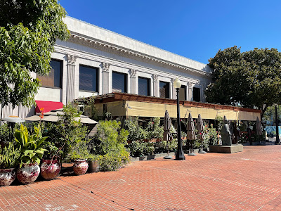
Ristorante Allegría in Napa
Ristorante Allegría is located in a former bank building. For lunch
we requested outdoor seating under the arbor.

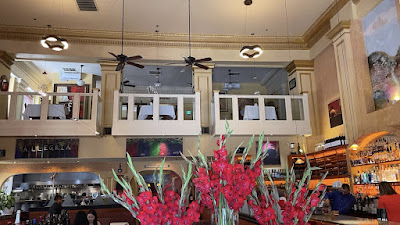
Interior of Restaurant
When entering the restaurant one is impressed by the different
settings for a dining experience.

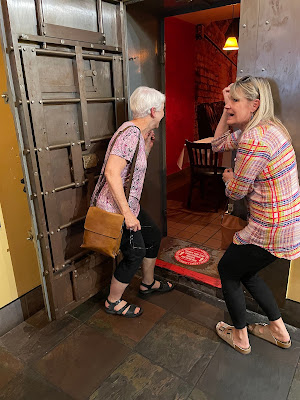
the bank vault
Martha and Rachel had fun taking a peek inside the vault.
Yes, private dining is available.

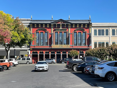
1879 in Napa
Not to be unequalled to anything in Old Sacramento, this building
caught Byron’s eye; truly beautiful architecture highlights
the colorful restoration.

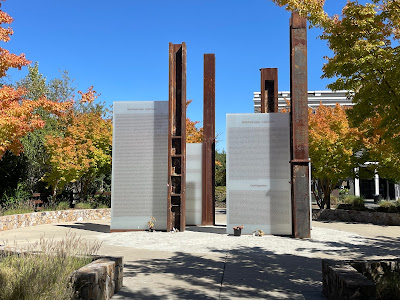
911 memorial in Napa
On our way back to the car, we came across a small park where
this 911 Memorial resides. Steel from the towers was used
in creating this fitting tribute to the workers and First Responders
who lost their lives on that horrible day 22 years ago.

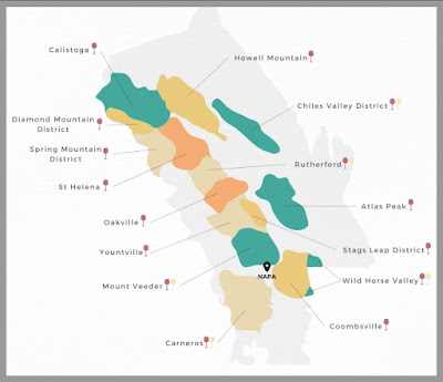
From the town of Napa, we headed north into Napa’s wine growing regions. The map (below) shows the sixteen viticultural areas. Though Napa is perhaps more famous, Sonoma County (to the west) is also well-known for their wineries. Byron wanted to visit the Benziger Winery but just north of Sonoma but, unfortunately, they were closed on the day we were visiting. He took a group there 25 years ago and thought the tour of their grounds was phenomenal. We learned that most wineries do close one day of the week. Thankfully, they all aren’t closed on the same day of the week.

apellation map
The map shows the different wine-growing regions of
the Napa Valley. Wishing this district are several wineries.
Each region may offer subtle differences in soil type,
annual rainfall, and exposure to sun. The result is different
types of rates grown to take advantage of the natural environment.

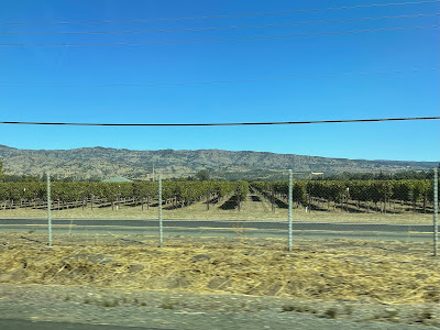
rows of grapes
This is a highway view of the vineyards distributed throughout
Napa Valley. This scene is nearly identical to what
may been seen across the ridge in Sonoma County’s wine region.

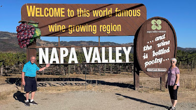
shameless marketing photo
Here we are, shamelessly promoting an area that provides
educational experiences, wine tasting, scenery galore, and history.

Our first stop was at St. Supéry Estate Vineyards and Winery. We enjoyed a delightful wine tasting orchestrated by Craig, our personal host. He provided us with some time to visit as we discussed memories and sipped a variety of wines.

Craig and Martha
While making a humorous comment, Craig pours a variety of wine
for Martha to taste. While tastings used to be free, that is no longer the case.

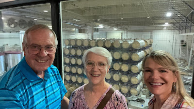
viewing the finishing area
The winery provides visitors with a place to view the three
types of fermenting systems; stainless steel, concrete-lined,
and oak tanks. The barrels (shown here) are use for storing the wine
after the fermenting process is completed.

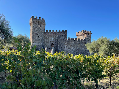
From St. Supéry, we headed to the north end of the valley to Castello di Amorosa, a location made to appear as a 14th century Tuscan castle. The structure spans 136,000 square feet with 107 rooms. It has four underground levels, and four above-ground levels. The castle is constructed of more than 8,000 tons of hand-chiseled local stone and nearly one million antique bricks imported from Europe. Though entrance into the castle is only be reservation, we were allowed to drive up to the parking lot and walk around the outside. 

Castillo Di'Amarosa
Surrounding the castle are olive trees, vineyards, and small gardens.

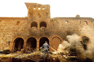
photo of Glass Fire damage
An archived photo shows the damage on one side of
Castello di Amoroso in the Glass Fire of September 2020. 
Much of the area around the castle was burned in the wildfire
that struck the area. As you can see from the picture above,
there is no evidence of the fire today.

Our last stop was Rombauer Vineyard. Rombauer’s structures survived the fire of 2020 because much of the fire was actually fought from their hilltop balconies. There is still evidence of scarring on the side of the hill below the winery. Rombauer

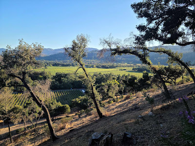
the hillside at Rombauer
Many trees were removed from the Rombauer property as
cleanup from the wildfire was done. What is captured here
is the view that was opened up because of the tree removal.

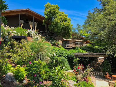
restored garden
Though some trees were destroyed and removed, the hillside
garden has been restored and is one beautiful part
to be see on the property.

We returned to Vacaville by way of the Silverado Trail. Our last stop of the day was to enjoy a burger at In-N-Out.

As you can tell, there was much to see and much to photograph. Best of all, we laughed and talked as we enjoyed great weather on a beautiful day with a wonderful tour guide, Rachel.
Day 29 - 10/03 - From Verdi to Vacaville and Old Sacramento

Today was another travel day; a day to go back over Donner Pass on our descent through Sacramento to Vacaville, California. Vacaville is located about 25 miles west-southwest of Sacramento. A partly cloudy sky with lots of sunshine, excellent visibility, and the moderate temperatures accommodated us well.  Compared to other driving days, this one was relatively short. We arrived in the middle of the afternoon and had time to replenish groceries before into Sacramento for dinner with our niece, Rachel. She is the daughter of Byron’ older brother, Lewis.

leaving Verdi toward Donner Pass
One of the interesting things about back-tracking is getting
to see scenery from another viewpoint. Such was the case today.
One sees the “other side of the hills” where the type of trees
and density is different. If you look closely, you can see the
trackbed of the railroad (the dark, horizontal line).

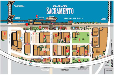
Sacramento, the town, was established as a transportation hub for the area and named for the river, the Sacramento River. Old Sacramento is in an historical section on the riverfront with many of the preserved buildings that now contain retail shops and restaurants. The original buildings were warehouses, hotels, transportation stations (freight and passenger), and business buildings. Some of the streets are still paved with cobblestones. The sidewalks in front of the buildings are of wooden planks.

Old Sacramento
The original buildings along the riverfront of Sacramento were
being vacated or abandoned. A forward-thinking mayor
led in the effort to raise funds and repurpose the area while
retaining a historical feel.
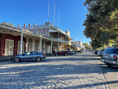
Old Sacramento and cobblestone streets
A stone paved street in Old Sacramento.

We had some time to walk through Old Sacramento before meeting Rachel for dinner. The two additional photos (below) give you an idea of the look and feel of Sacramento before the 1880’s.

Old Sacramento wholesale grocer
This building formerly housed the warehouse and office of
a wholesale grocer.

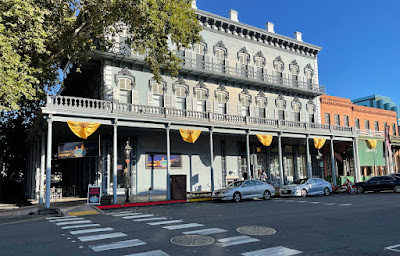
Old Sacramento hotel
A former hotel now serves as an apartment building 
in Old Sacramento.

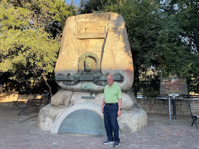
A statue at the end of one street commemorates the contribution made by engineer Theodore Judah. Judah was instrumental in construction of the Transcontinental Railroad through the Sierra Nevada and Rocky Mountain ranges. Another statue commemorates the Pony Express route which ended in Sacramento. 

Judah memorial
The historical marker for Theodore Judah.

pony express
The statue (behind us) commemorates the Pony Express.

wooden buffalo
The wooden statue in front of Buffalo Bob’s store.

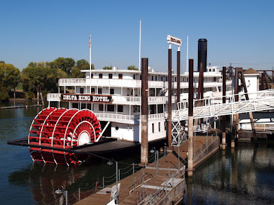
Delta King Hotel
The Delta King is permanently moored on the riverfront and
now serves as a boutique hotel with restaurant. The Delta Queen,
which began life serving the San Francisco and Sacramento
route, was built and completed in 1927. That was the year both
sternwheelers began service on the Sacramento River

Dinner with Rachel was on the deck of Rio City Cafe. It is on the edge of the Sacramento River near the Tower Bridge and adjacent to the Delta King Hotel.

Rio City Cafe
Dinner with Rachel on the riverfront of Old Sacramento.
capitol building in Sacramento
After dinner, we drove to the capitol building in Sacramento
to get this night shot.

Thursday, October 5, 2023

Day 28 - 10/02 - Around Lake Tahoe

This was the day we took off to see Lake Tahoe, from the northeast to the southwest and back again. This day also marks a milestone of sorts. We’ve seen the largest lake in the USA (not including the Great Lakes) and the deepest one. Polson Lake in Montana is the largest by surface area and Lake Tahoe is the deepest. Both are easy to see from 30,000 feet in the air because they both are large by any standard.

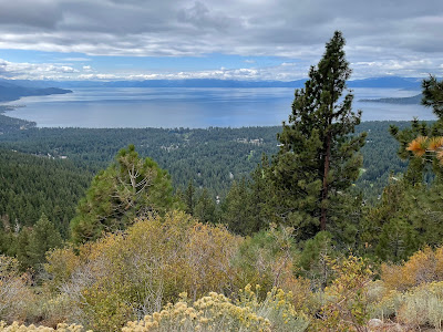
Tahoe from above Incline Village
Though partly cloudy, Lake Tahoe (surrounded by mountains) sits
on the dividing line between California and Nevada. This was our
first glimpse after cresting Mount Rose at a viewing point
above Incline Village on the northeaster shore.

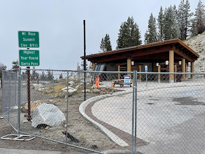
Mount Rose Summit
Though the rest area was closed for renovation, we still got the
photo documentation of our highest elevation thus far; 8,911 feet.
Yes, are above the cloud level for the day at the time this was taken.
Visibility was less than 1/4 mile.

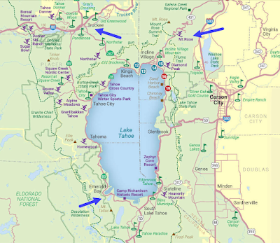
Tahoe Map
We came into the Lake Tahoe area from the northeast over Mount Rose
(the arrow in the upper right). We drove around the wester side
of the lake to Emerald Bay (the arrow in the lower left). We exited
the area by way of Truckee (upper left) and returned to the RV resort
on I-80. There are a lot of places for skiing around Tahoe.
During the summer, boating is equally popular.

From the RV resort at Verdi, we drove past Reno to get onto Highway 431 toward Incline Village in our Lincoln MKX, the vehicle we tow behind the motorhome. We topped Mt. Rose at 8,911 feet. That elevation is our highest point to date. From Mount Rose he headed down downward toward Incline Village. From Incline Village we headed west and south around the lake before reaching our intended destination of Emerald Bay State Park.

The parking lot at Emerald Bay was closed due to construction on the Vikingsholm Trail. In search of a parking spot and a view of Emerald Bay on the south end of Lake Tahoe, we traveled around the wet end of the bay and up an incline. We found a  great viewing spot along the edge of the road. The clouds had parted, and we had a beautiful view of the lake and the mountains surrounding the Lake Tahoe.

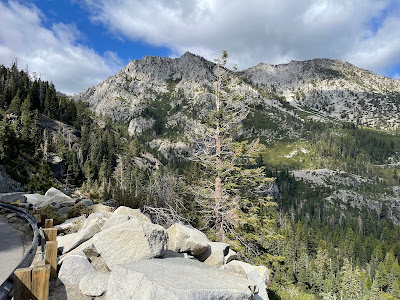
the mountain peaks above Emerald Bay
Looking up to the mountain peaks above and to the west of
Emerald Bay on Lake Tahoe.

looking downward to the island in Emerald Bay
Looking down to the island in Emerald Bay. What appears to be
a speck near the island is a yacht that is probably
near 50 feet in length if not more. Fannette is the only island
to be found in all of Lake Tahoe. It is a sparsely timbered,
brush-covered upthrust of granite that rises
150 feet above the waters of Lake Tahoe.

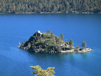
Fannett Island
The stone structure on top that looks like a miniature castle
is the “Tea House” built during the same time
that Vikingsholm was constructed. Vikingsholm
is on the mainland just west of the island.

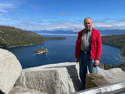
overlooking Emerald Bay
Oh, say, can you see who is on the yacht from the rocks
along the roadside? Not really. Why do you ask?

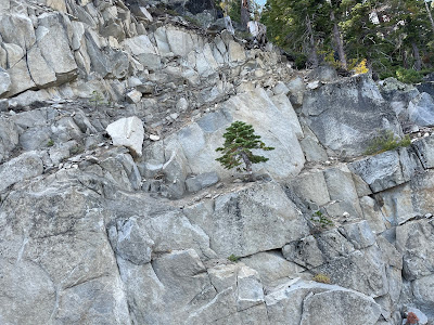
tree in rocks above Emerald Bay
Martha spotted this tiny tree growing out the the rocks
across from where we stopped for a view of Emerald Bay.

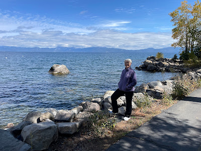
On our way back around the lake, we stopped for a one-mile walk along the edge of the lake. The paved surface runs for many yards and is interspersed around portions of Lake Tahoe.

The whole area, though very commercialized, is quite beautiful. If one is careful and plans well, finding a bit of privacy is not really difficult on the path, among the many park-like settings, and other spaces.

standing by the lakeshore of Tahoe
A pedestrian/bike path is available around much of Lake Tahoe,
something that wasn’t in place 25 years ago.

Day 27 - 10/01 - Red Bluff to Reno

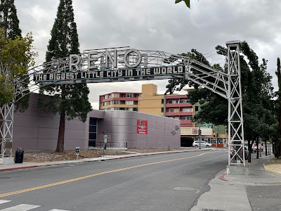
This was Sunday and a day of great weather as well as variety. We did a lot. We watched the service from our home church in Louisville via live stream (10:30 there was 7:30 here). After that, we headed toward “The Biggest Little City,” Reno, Nevada.

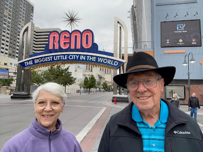
At Reno - color sign
Welcome to Reno. Can you tell it was a little bit cool? This sign
replaced an earlier version about a decade ago.

We could have cut across to a pass just southwest of Red Bluff but decided to take the less curvy route; the one maintained as an interstate highway. We headed toward the northern edge of Sacramento where we’d jump from I-5 via a connector to merge onto I-80 toward Tahoe and Reno. We had reservations at a campground between Truckee and Reno and arrived there after going over Donner Pass. It was only a distance of 248 linear miles but a change in elevation from up to down, back up, and then down.

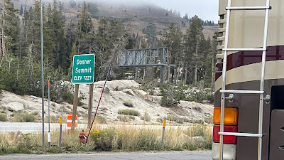
topping out at Donner Pass
We topped Donner Pass at 7,227 feet before dropping back
to 6,000 feet when we reached Verdi, Nevada. The official
temperature while at the rest stop was 35°F. It was funny
watching kids run to and from the restrooms wearing
short-sleeved shirts and short pants. Unprepared!

Though Byron had made the trip 25 years ago, this was Martha’s first of going into Nevada from Sacramento. Byron got us to just north of Sac but Marth took over the rest of the way. She did well. She put the throttle down, held onto the steering wheel, and just let the motor home do what it wanted to do. The Allison transmission did what it was supposed to do as did our Caterpillar 3126e engine. When we arrived at Verdi, Martha commented that it seemed easier than our days in the Cascades and was actually an enjoyable!

site at the RV resort
This was the view of the Sierras from our site in Verdi, Nevada.
This is looking westward. Verdi sits above and northwest of Reno along I-80.

another view, looking eastward
This was the view of the mountains looking eastward from
the RV resort. Do you see the stark difference? Even
the dry slope produce their own kind of beauty.

After a nap and some nourishment, we had time left in the afternoon and took off for Reno. We had two things to accomplish: A walking tour of the city and a walk through the casinos owned by Ceasar’s Entertainment.

We loaded the narration for the walking tour to our phones once we arrived near the center of Reno. The tour was quite interesting and covered a good bit of historical information over the course of the 45 minutes. We learned how important the Truckee River was to Reno’s founding, how it was abused by the 1920’s, and how it has been rehabilitated. We also learned how the impact of legalized gambling and lax divorce laws helped the city flourish and how the city has managed to transform itself through time.

the original sign at Reno
The walking tour took us past the original sign designating
Reno as the biggest little city. Byron’s father took a photo of this sign
in 1958 when the train was stopped. Byron saw it in 1998 
near the railroad depot and the entrance to casino row.
The sign was moved to this location when the newer one (above) was erected.

As to the abuse of the Truckee River, the natives of the area had survived for hundreds of years along the Truckee without harming the water or preventing the migration of fish for spawning. The river was originally home to Lahontan cutthroat trout and cui-ui sucker. During normal years, adult trout ascended from Pyramid Lake and descended from Lake Tahoe to the Truckee River and its tributaries to spawn. Settlers from the east ruined that. They over-fished the Truckee (shipping tons of fish via railroad regularly) and dumped mining waste into it. The straw that broke that camel’s back was the sawdust and residue from sawmills clogging the Truckee so the fish could not come and go. (Conservation was not important at that time like it has become today.) Thankfully, conservationists got the attention of the locals and restoration of the Truckee River has been done including the restoration of fish to the waters.

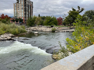
Truckee River and island
For the first 75 miles, the Truckee is a cascading river as it 
flows to Pyramid Lake in the Great Basin. This photo shows
how the Truckee formed an island in the central part of Reno.

After the walking tour, we moved through Silver Legacy Casino in search of the performance at Circus Circus Casino. Unfortunately, the performers were on break at the time we were there. So, we returned by walking through the string of three casinos that are connected by above-street walkways.

mining structure
The large display of a silver mining structure can been at the
Silver Legacy Casino for many years. The big flywheels
and pulleys function in a brief show on an hourly basis.


Monday, October 2, 2023

Day 26 - 9/30 - Medford to Red Bluff for a Visit

Another travel day is in the books. Now it’s in the blog. Guess what? We started the day at an elevation of 1,098 feet and ended the day at an elevation of 350 feet. No, it was not down hill all the way. It was more up and down through the Cascades of southwestern Oregon into the northern part of California on I-5. We topped our highest peak of the day, Siskiyou Summit, at 4,310 feet. There were quite a few up and downs in addition to the pass.

We arrived at our destination of Red Bluff KOA by midafternoon. Our purpose for this stop was to visit with Gary and Rebecca Bovee. Gary is a friend of Byron’s through a GMC motorhome In fact, Gary and Byron collaborated on a popular publication within the GMC community; The Internet Idiot’s Guide to the GMC Motorhome. Gary wrote the material, Byron added many illustrations and laid it out in preparation for distribution as a PDF or in iBook format. 

Gary, Rebecca, Martha, and Byron
Here we are with Gary and Rebecca in front of two, gigantic
Redwood trees. They were planted when he was a child
on the farm of his grandparents where he and his wife now live.
The upper third of one tree was blown out by a storm
and the same thing happened to another a few years later.
From the ground, it is impossible to see any sign of damage
since the trees are still nearly seventy feet high.

We had a lovely visit to Gary and Rebecca’s home which sits amid two acres of English Walnut trees. Rebecca presented us with a lovely gift box filled with almonds, English walnuts, pistachios, candied pecans, peaches, pears, pomegranate, tomatoes, honey, dried plums, and home-grown bay leaf. All these items are products of the Red Bluff area. In addition to all the goodies, she gave us a lovely vase of long-stemmed yellow mums. For many years, both Gary and Rebecca worked in different departments for county government.

After a nice dinner at a local restaurant, we returned to the campground for the evening. We're grateful to have met some “internet friends” on this trip and are glad to count them as friends.

Red Bluff KOA Journey
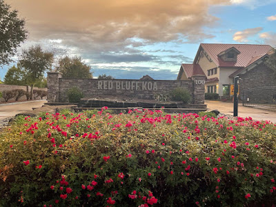
Red Bluff KOA Journey is one of the nicer campgrounds
at which we have stayed on our journey. The sites
were spacious with concrete pads and asphalt streets.

an Oregon butte
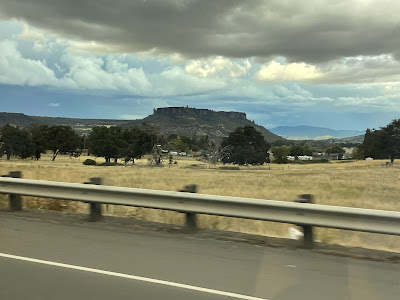
Somewhere along the way we spotted this butte in the distance.
This was taken while in a dry valley. The area, between mountain ranges,
reminds us of the high desert of Wyoming.

Day 25 - 9/29 - Crater Lake National Park

Crater Lake National Park is northeast of the Medford region of Oregon. Gold Hill, the small town where we are camped, is at a lower level than Crater Lake which was formed by a volcanic eruption.

Armed with our lunch, water, a full tank of gas, and some rain, we set off a little after 9 o'clock for a 60-mile drive to the national park. We drove across the valley floor to make our ascent to the rim. Our first stop was the obligatory park entrance. We got a photo of us at the sign as our form of documentation.

Byron and Martha - Crater Lake
One of the necessary functions is getting a photo of us at an
entrance to our tour location for the day. Oddly, the Crater Lake
sign doesn’t comply with the typical one but it does serve the purpose.

overview of the region
The small, green area in the center of this map is the boundary
of Crater Lake National Park. A high and mountainous
rim from the caldera surrounds the lake.

Crater Lake map
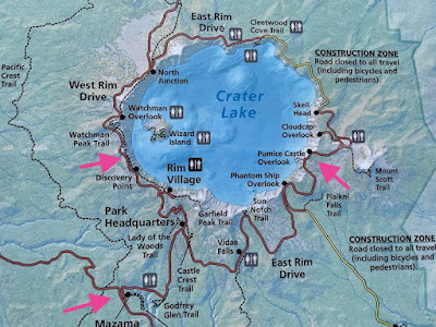
This is a more detailed map of the national park. We entered
the park at the arrow on the bottom and drove the roads
from one arrow to the other. It is 33 miles around the
entire perimeter but, due to closures, we couldn’t make that trip.

We entered Crater Lake through the West Entrance. From there we drove up to Rim Village and to an elevation of 7,100 feet. It was definitely rainy with foggy conditions. This and the low ceiling prohibited almost any view of the lake.

view of Crater Lake through clouds
The photo (after enhancement) does show the outline of the lake
where it meets the mountain rim (edge of the water).
A bit fuzzy, huh?

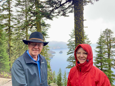
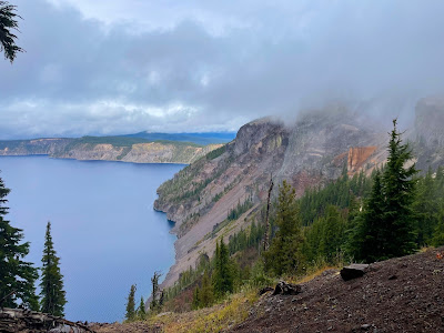
Not to be denied a view of the lake, we headed on up the West Rim toward Watchman Overlook at 8,013 feet. Unfortunately, the views there were even more non-existent. So, we headed back toward the entrance and up the East Rim. Stopping at Phantom Ship Overlook, where the clouds we not an issue, we got our first view of Crater Lake and the Phantom Ship Island.

at Phantom Ship Overlook
Phantom Ship resembles a small sailboat but is actually
as tall as a 16-story building. It is the oldest (400,000 years old)
exposed rock within the caldera. It is made up of erosion-resistant rock.
Crater Lake was formed in the plugged caldera of Mazama,
the massive volcano that shaped this area millions of years ago.

Since it was raining, we ate our picnic lunch in the car overlooking the lake and then headed up the East Rim for another two miles stopping at Victor View. It gave us a better view of the lake. The last stop was near Pumice Castle Overlook.

Pumise Castle Rock
On the right side of this photo can be seen the pumice rock
that is on the southeast rim of the park.

Leaving the park, we drove along Upper Klamath Lake into Klamath Falls. We stretched our legs with a one-mile hike to the Link River Falls while in Klamath Falls, and no, there is no waterfall! All-in-all, we traveled about 200 miles on Friday!

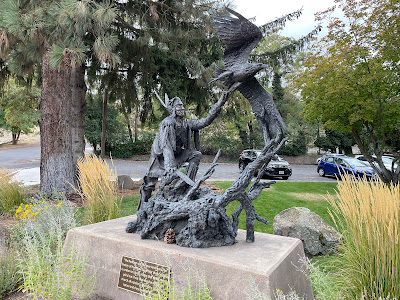
bronze statue at Klamath Falls
A bronze statue at Klamath Falls Museum. The inscription reads:
“The Redman was the true American.
The history of how they fought for their country
is written in blood, a stain that time cannot grind out.
Their God was the sun, their church all outdoors,
their only book was nature and they knew all its pages.”

cascades on the short Link River
Between Upper Klamath Lake and the Klamath River is
a short channel of water called the Link River. There is
a section that features cascading water passages.


Days 24 - 9/28 - Portland to Medford

On Thursday, we traveled from the Portland area to the Medford area where we stopped at the KOA in Gold Hill, Oregon. Along the way took an extended break at Eugene where we visited Kelvin and Cindy Dietz. 

Byron and Kelvin connected through an online group of GMC MotorHome owners nearly a decade ago. Kelvin contacted Byron to design a paint scheme for his coach. The final job was done 10 years ago and Kelvin says he’s still pleased to tell folks that Byron was involved. Since then, Byron has other graphic design work for him.

Our first motorhome was a vintage GMC coach that we owned for three years. We got greatly involved in some of the FMCA groups dedicated to the GMC unit. GMC produced these from 1973 through 1978 and thousands of them are still operational today. The drivetrain was based on the front wheel drive Oldsmobile Toronado with a ride-dampening suspension developed especially for the motorhome.

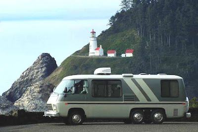
GMC at Heceta Head
Kelvin and his wife enjoy their vintage GMC. It was repainted
nearly ten years ago based final design by Byron. Here it is
shown on the Oregon Coast with Hecta Head Lighthouse
in the background.

We have learned a thing or two about this RV trip planning app Martha used for this trip. Just because it says an RV can travel a road doesn’t necessarily mean you want to be on that road. We were on a highway that traversed up and down and around at speeds of 45 miles and hour or less. We saw beautiful Oregon countryside in the Cascades. The drive was not very restful but we made it with no problems encountered.

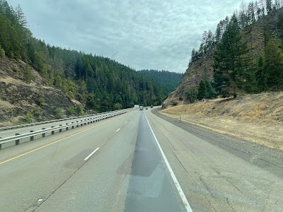
We were primarily on I-5 for this segment of the trip. Though we didn’t encounter sharp curves or narrow roadways, we did encounter steep inclines. A 7% grade is not uncommon in the Cascades. At times our uphill speed got down to 38 (and all the hamsters in the cage were pedaling hard). It makes one very thankful for truck lanes. Holding it below 55 on the downhill slopes was challenging, too. It makes one very thankful for thing like engine braking as well as good, mechanical brakes.

traveling on i-5
Steep slopes line the way just as steep inclines provide driving challenges.
This is the experience of driving in the Cascades of Oregon and Washington.

Of course, in this area there are several plateaus with large, open fields where there are groves of fruit trees or cattle and sheep farms. It is just amazingly beautiful.

Once at the KOA in Gold Hill just north of Medford, we had a good opportunity to rest in preparation for the touring to be done at Crater Lake National Park. At this KOA we were settled in among the trees and parked on a surface of small pebbles.

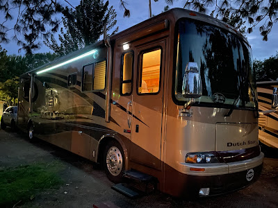
Dutch Star at Night
Martha took this photo of our Newmar Dutch Star without
the use of flash on her iPhone. It came out looking great.
The LED light strip is our primary security lighting at night.
By the way, the paint scheme of our rig was also done by Byron.