Monday, October 2, 2023

Day 25 - 9/29 - Crater Lake National Park

Crater Lake National Park is northeast of the Medford region of Oregon. Gold Hill, the small town where we are camped, is at a lower level than Crater Lake which was formed by a volcanic eruption.

Armed with our lunch, water, a full tank of gas, and some rain, we set off a little after 9 o'clock for a 60-mile drive to the national park. We drove across the valley floor to make our ascent to the rim. Our first stop was the obligatory park entrance. We got a photo of us at the sign as our form of documentation.

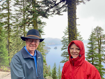
Byron and Martha - Crater Lake
One of the necessary functions is getting a photo of us at an
entrance to our tour location for the day. Oddly, the Crater Lake
sign doesn’t comply with the typical one but it does serve the purpose.

overview of the region
The small, green area in the center of this map is the boundary
of Crater Lake National Park. A high and mountainous
rim from the caldera surrounds the lake.

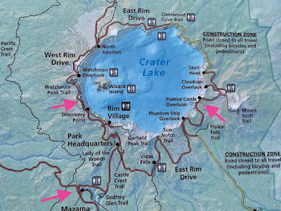
Crater Lake map
This is a more detailed map of the national park. We entered
the park at the arrow on the bottom and drove the roads
from one arrow to the other. It is 33 miles around the
entire perimeter but, due to closures, we couldn’t make that trip.

We entered Crater Lake through the West Entrance. From there we drove up to Rim Village and to an elevation of 7,100 feet. It was definitely rainy with foggy conditions. This and the low ceiling prohibited almost any view of the lake.

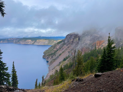
view of Crater Lake through clouds
The photo (after enhancement) does show the outline of the lake
where it meets the mountain rim (edge of the water).
A bit fuzzy, huh?

Not to be denied a view of the lake, we headed on up the West Rim toward Watchman Overlook at 8,013 feet. Unfortunately, the views there were even more non-existent. So, we headed back toward the entrance and up the East Rim. Stopping at Phantom Ship Overlook, where the clouds we not an issue, we got our first view of Crater Lake and the Phantom Ship Island.

at Phantom Ship Overlook
Phantom Ship resembles a small sailboat but is actually
as tall as a 16-story building. It is the oldest (400,000 years old)
exposed rock within the caldera. It is made up of erosion-resistant rock.
Crater Lake was formed in the plugged caldera of Mazama,
the massive volcano that shaped this area millions of years ago.

Since it was raining, we ate our picnic lunch in the car overlooking the lake and then headed up the East Rim for another two miles stopping at Victor View. It gave us a better view of the lake. The last stop was near Pumice Castle Overlook.

Pumise Castle Rock
On the right side of this photo can be seen the pumice rock
that is on the southeast rim of the park.

Leaving the park, we drove along Upper Klamath Lake into Klamath Falls. We stretched our legs with a one-mile hike to the Link River Falls while in Klamath Falls, and no, there is no waterfall! All-in-all, we traveled about 200 miles on Friday!

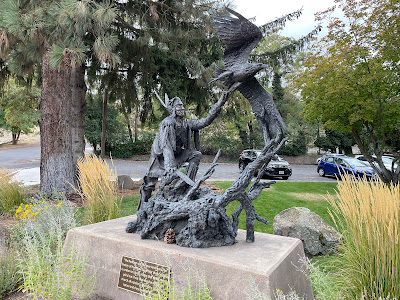
bronze statue at Klamath Falls
A bronze statue at Klamath Falls Museum. The inscription reads:
“The Redman was the true American.
The history of how they fought for their country
is written in blood, a stain that time cannot grind out.
Their God was the sun, their church all outdoors,
their only book was nature and they knew all its pages.”

cascades on the short Link River
Between Upper Klamath Lake and the Klamath River is
a short channel of water called the Link River. There is
a section that features cascading water passages.


No comments:

Post a Comment