This was the day we took off to see Lake Tahoe, from the northeast to the southwest and back again. This day also marks a milestone of sorts. We’ve seen the largest lake in the USA (not including the Great Lakes) and the deepest one. Polson Lake in Montana is the largest by surface area and Lake Tahoe is the deepest. Both are easy to see from 30,000 feet in the air because they both are large by any standard.

Though partly cloudy, Lake Tahoe (surrounded by mountains) sits
on the dividing line between California and Nevada. This was our
first glimpse after cresting Mount Rose at a viewing point
above Incline Village on the northeaster shore.

Though the rest area was closed for renovation, we still got the
photo documentation of our highest elevation thus far; 8,911 feet.
Yes, are above the cloud level for the day at the time this was taken.
Visibility was less than 1/4 mile.

We came into the Lake Tahoe area from the northeast over Mount Rose
(the arrow in the upper right). We drove around the wester side
of the lake to Emerald Bay (the arrow in the lower left). We exited
the area by way of Truckee (upper left) and returned to the RV resort
on I-80. There are a lot of places for skiing around Tahoe.
During the summer, boating is equally popular.
From the RV resort at Verdi, we drove past Reno to get onto Highway 431 toward Incline Village in our Lincoln MKX, the vehicle we tow behind the motorhome. We topped Mt. Rose at 8,911 feet. That elevation is our highest point to date. From Mount Rose he headed down downward toward Incline Village. From Incline Village we headed west and south around the lake before reaching our intended destination of Emerald Bay State Park.
The parking lot at Emerald Bay was closed due to construction on the Vikingsholm Trail. In search of a parking spot and a view of Emerald Bay on the south end of Lake Tahoe, we traveled around the wet end of the bay and up an incline. We found a great viewing spot along the edge of the road. The clouds had parted, and we had a beautiful view of the lake and the mountains surrounding the Lake Tahoe.
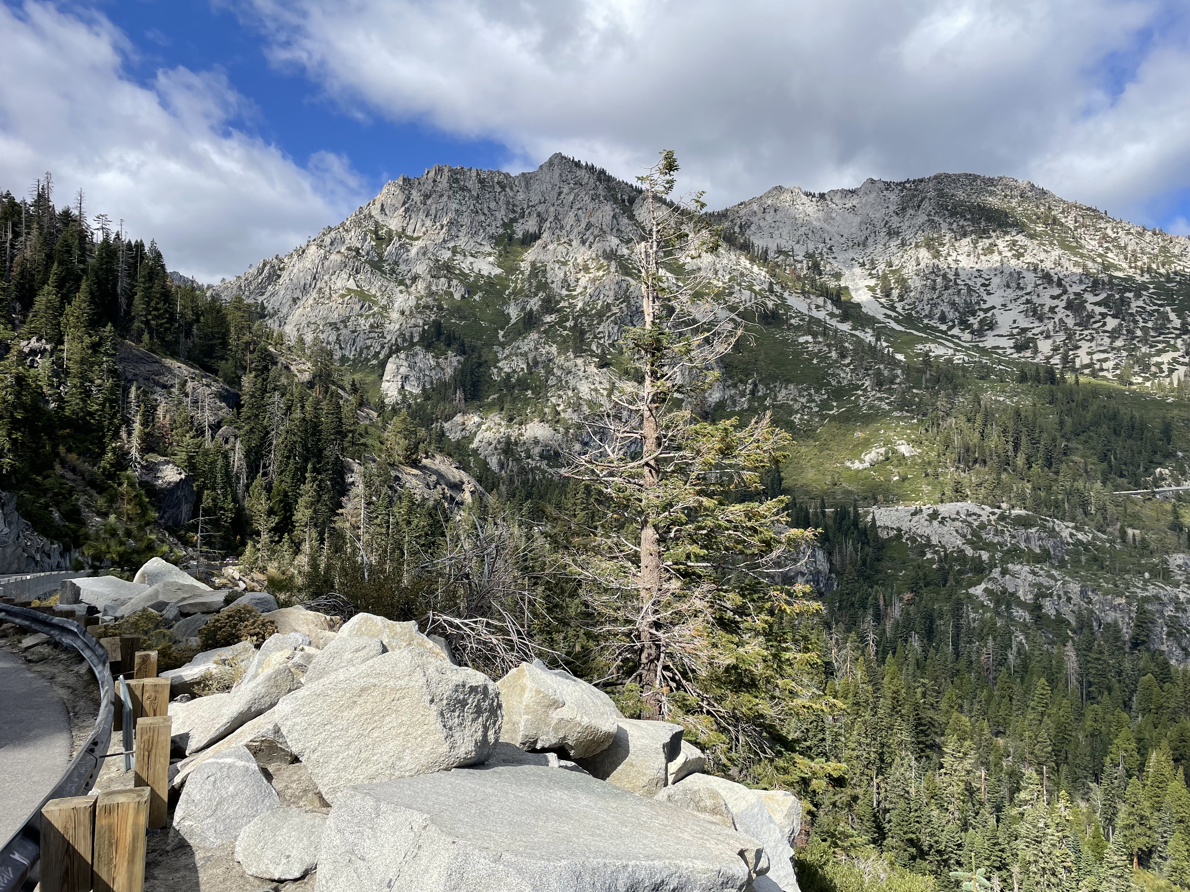
Looking up to the mountain peaks above and to the west of
Emerald Bay on Lake Tahoe.
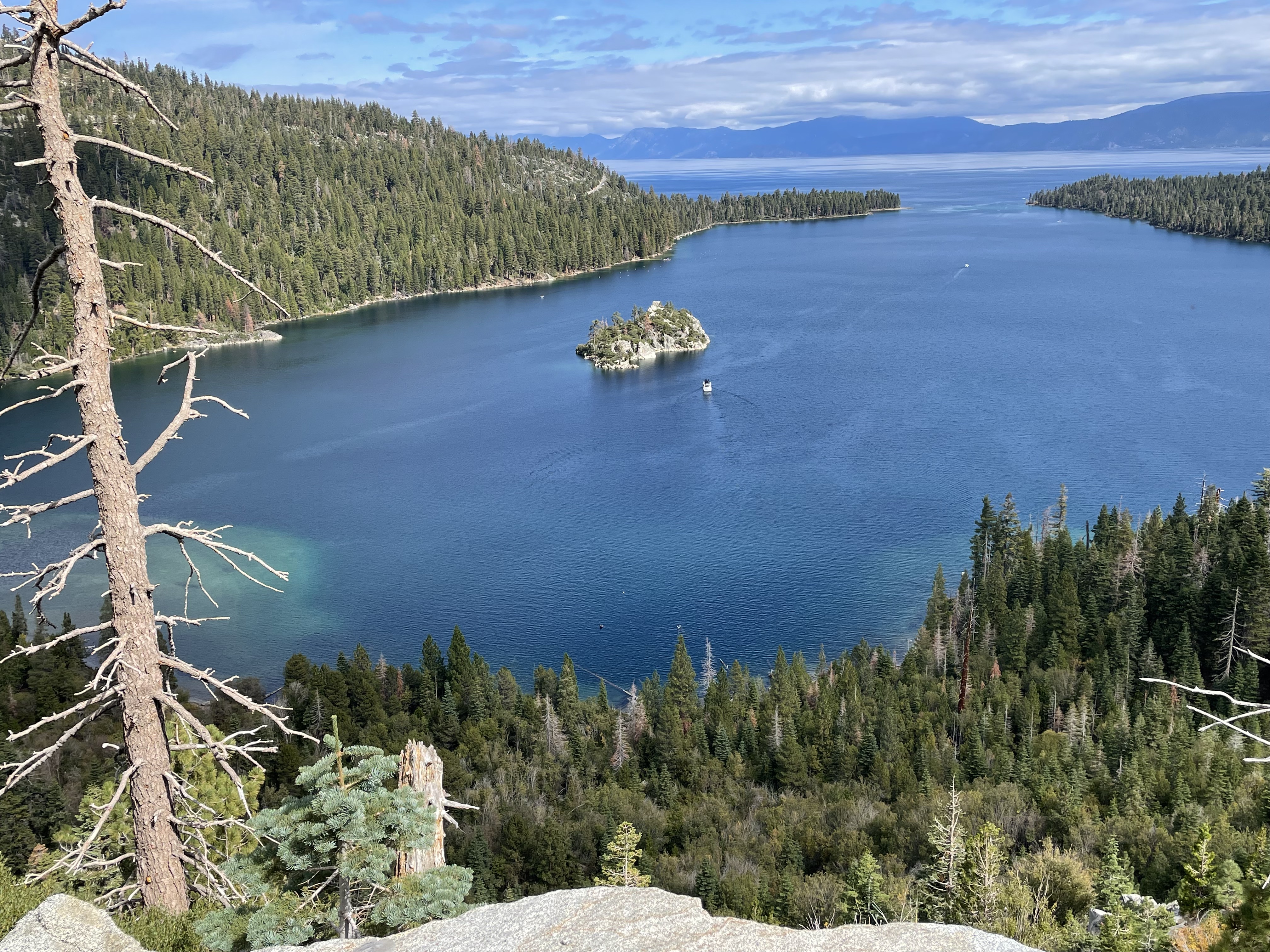
Looking down to the island in Emerald Bay. What appears to be
a speck near the island is a yacht that is probably
near 50 feet in length if not more. Fannette is the only island
to be found in all of Lake Tahoe. It is a sparsely timbered,
brush-covered upthrust of granite that rises
150 feet above the waters of Lake Tahoe.

The stone structure on top that looks like a miniature castle
is the “Tea House” built during the same time
that Vikingsholm was constructed. Vikingsholm
is on the mainland just west of the island.

along the roadside? Not really. Why do you ask?

Martha spotted this tiny tree growing out the the rocks
across from where we stopped for a view of Emerald Bay.
On our way back around the lake, we stopped for a one-mile walk along the edge of the lake. The paved surface runs for many yards and is interspersed around portions of Lake Tahoe.
The whole area, though very commercialized, is quite beautiful. If one is careful and plans well, finding a bit of privacy is not really difficult on the path, among the many park-like settings, and other spaces.
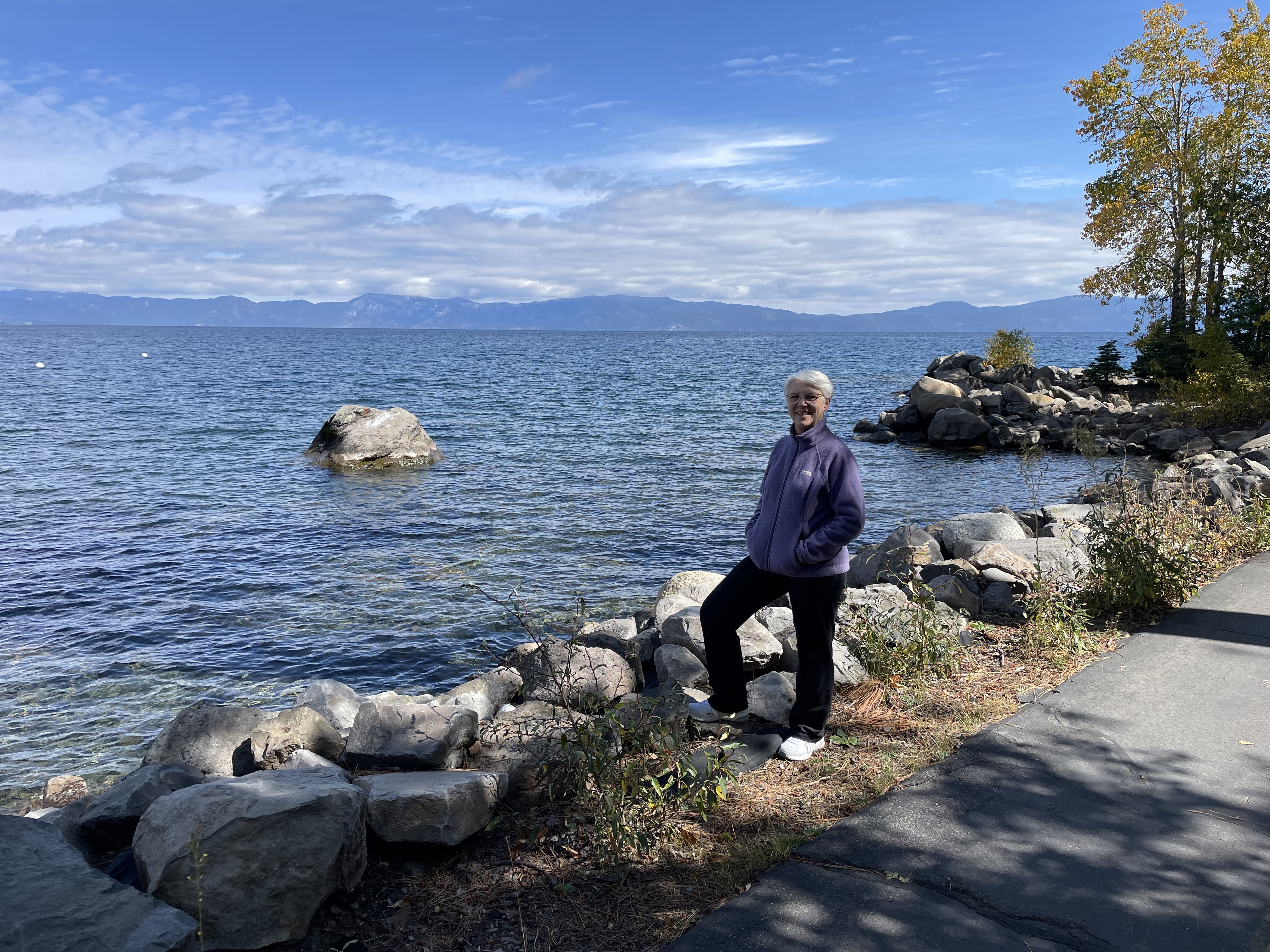
A pedestrian/bike path is available around much of Lake Tahoe,
something that wasn’t in place 25 years ago.
No comments:
Post a Comment